

A short fieldguide
Where are we going ?
Crawton is a small collection of houses on the coast just south of Stonehaven in coastal Aberdeenshire.
Driving/cycling part: Just a few minutes drive on the A92 South of Dunnottar castle, take the left turn towards the coast, (signposted to Crawton, NO 873 810). You can park on the layby spaces on the right hand side of the road at the RSPB location (map) - there is also a small square car park just past the layby area.
The walking part: Follow the blue route from A to C past the village on your right hand side. On leaving the village you will pick up a path off road (yellow) that winds it way down to the pebble beach that is Crawton Bay. You’ll pass some ruins of old fisher houses. This walk takes around 10 - 15 minutes and is best to wear hard wearing boots (with ankle support if possible) and of course to be prepared for four seasons in 1 day. It’s easy going but can be slippery in places.
A slightly longer route is to take the path (wooded on sides) about half way between B - C which follows the southern side of the small bay which has a quite spectacular waterfall (the Crawton waterfall on maps) on it’s northern side. You can then follow the path to pick up the yellow route.
This will take you 1- 2 hours walking from A and then back to A on the same route.
What are the pointy rock outcrops (into the sea) that we see on Google Maps ?
The pointy rock outcrops (into the sea) are actually lava flows and the bays are mainly made up of conglomerate which was less resistant to erosion than the lavas. The lavas were erupted from an ancient volcano during the Devonian Period (making up most of the Old Red Sandstone), pouring out over the underlying conglomerates.
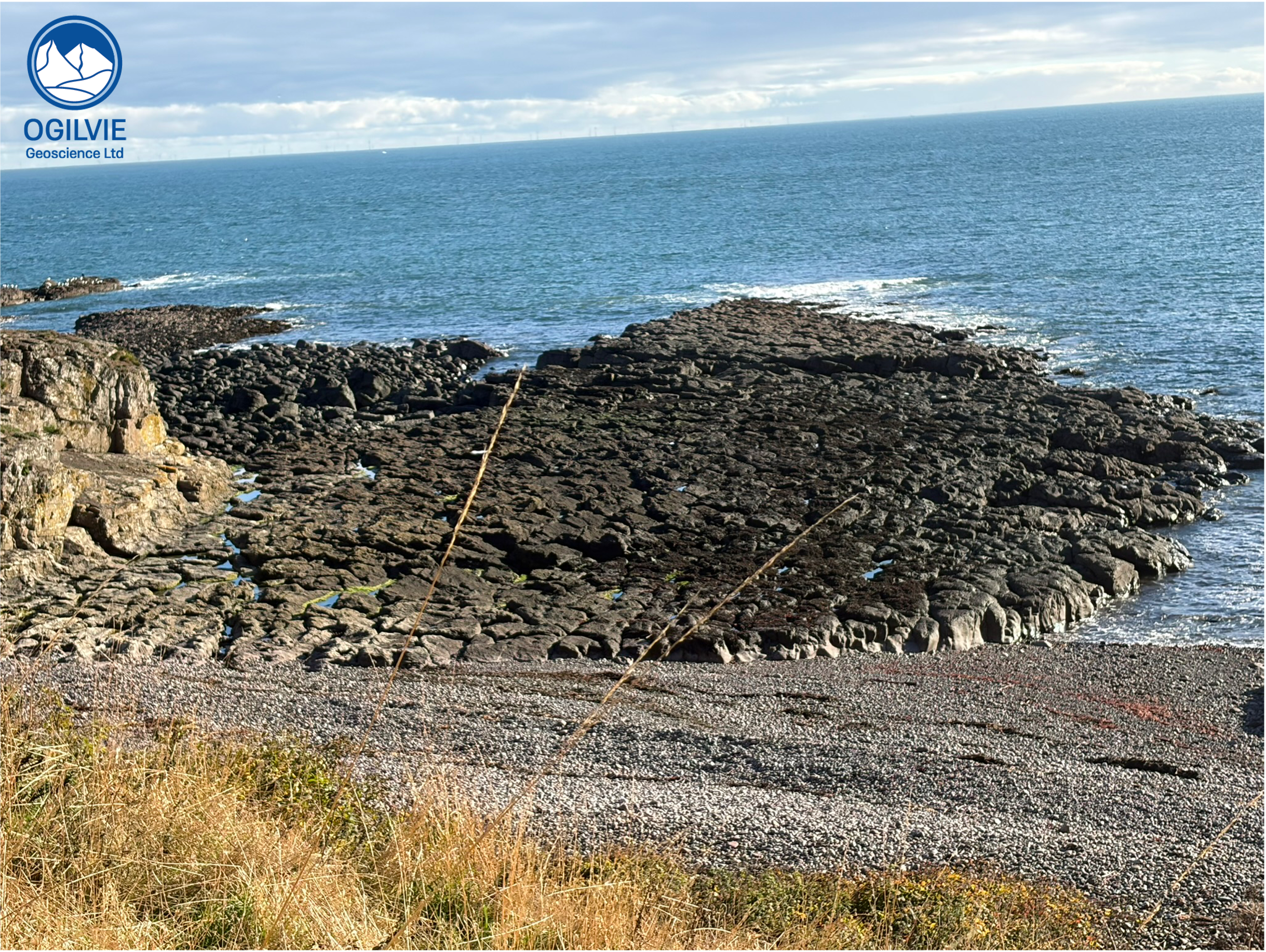
Upper lava flow that is rich in large minerals that fill holes
The Geology at Crawton
The geology here are is series of lava flows that are found overlying and underlying the Crawton conglomerates of Old Red Sandstone age. We can therefore say that the lavas are interbedded with the conglomerates. The uppermost flow is shown opposite and it’s worth walking across it (at low tide as is the case here) and looking out for some of these often rather large minerals.
The back of the bay and it’s North (south facing side) is a sheer wall of conglomerates - these rocks represent ancient alluvial fans. There are some huge boulders in there telling us that these haven’t come from that far away !
Please do not hammer any of these rock exposures as the Crawton area is a SSSI - it is a site of special scientific interest
What are zeolites ?
Type of mineral that is common in the lavas at Crawton. As they fill holes (vesicles) in the lavas, the features are generally called amygdales. They are particularly common in the uppermost lava flow which forms a flat pavement like exposure on the north end of Crawton Bay itself (opposite)..
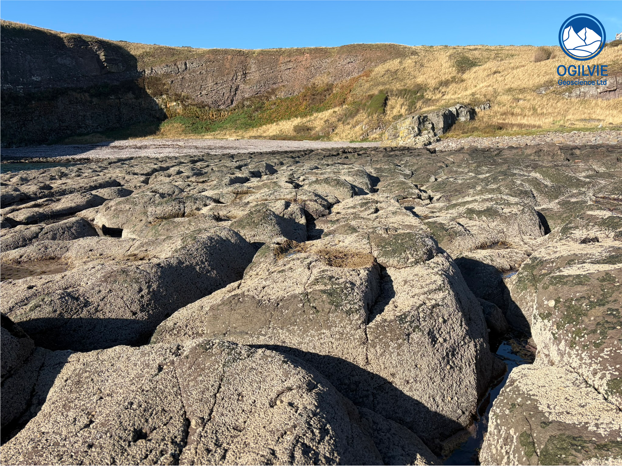
View along the top lava flow surface towards the conglomerates at the back of the Crawton Bay which dip to our left
Where is it best to see the zeolites ?
Filling holes (vesicles) in ancient lavas - on the uppermost lava flow on the south side of Crawton Bay (at the end of the yellow route on map). This is one of 4 lava bodies shown on the map on Trewin’s field guide; labelled as lava 4 [1] - it is the easiest lava body to reach.
Best places on this (often purple coloured) basalt are either along the sides where sea water has smoothed and cleaned the surfaces or on top (as you walk over it) in rock pools in the lava which have formed through widening and deepening of various cracks. This create a rather rugged pavement (opposite)..
The images below are from one of other lava bodies (#3 in Trewin’s guide) found further north from here. There is an irregular contact between the lava and the conglomerate - in fact the lava has been eroded before the conglomerate was deposited on top of it.
Often you’ll see a mixture of needle shaped minerals (likely feldspar) together with blobs of mainly calcite and quartz of various sizes. Although mainly made of calcite and quartz, the blobs also contain a red-brick like mineral called stilbite. Stilbite is a type of zeolite (a mineral group) and its not that common to find it with this red-brick like colour (often lighter pastel shades). So this area is rather special !
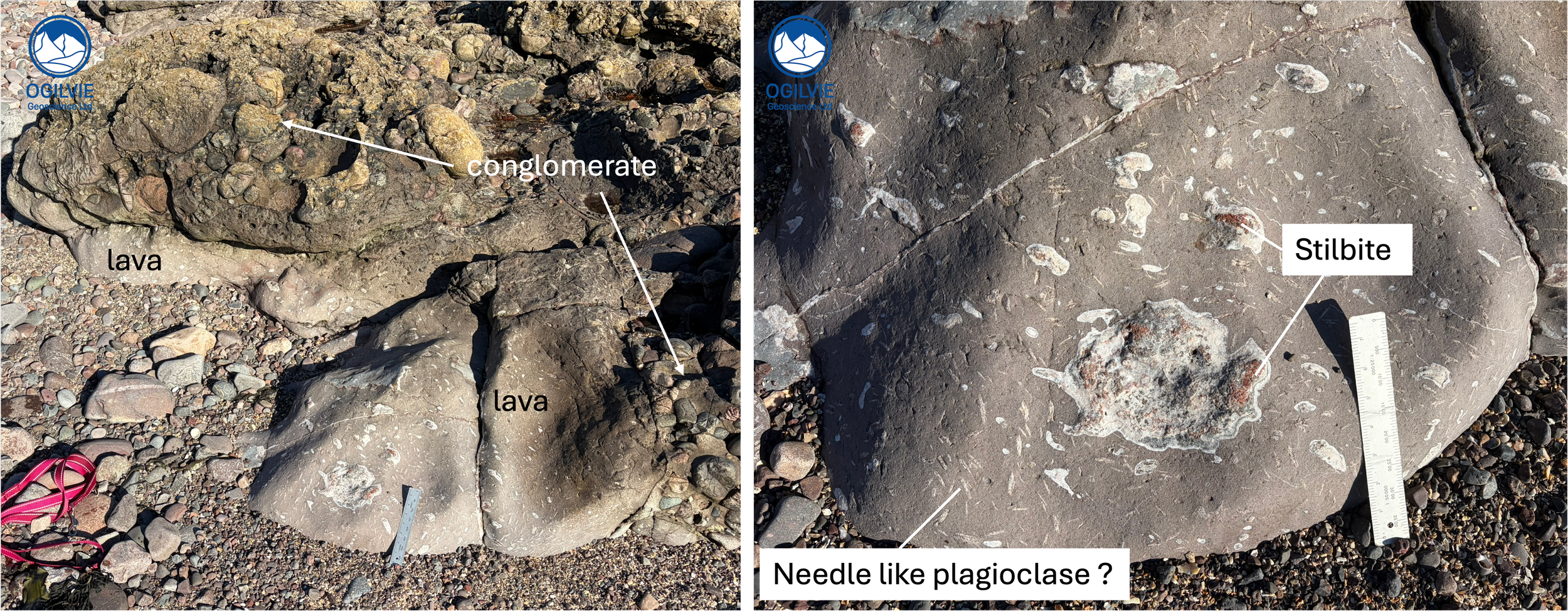
Contact between conglomerate and lavas at Crawton and (on right) close up of the zeolites (some are stillbite) together with needle like quartz and calcite minerals in the lava.
Are these pillow lavas like those at Stonehaven ?
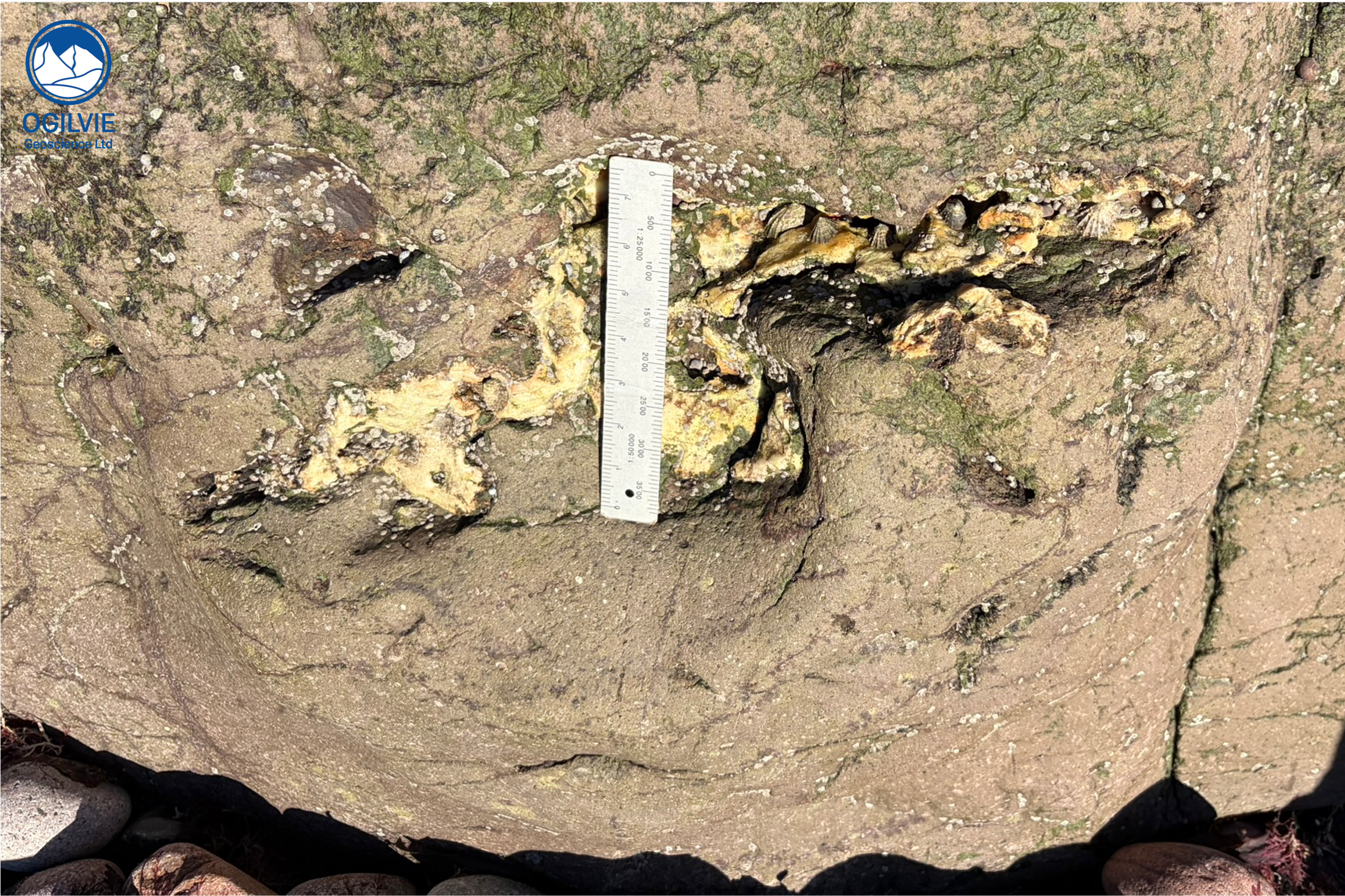
One of the largest mineral fills (that I found anyway) on the uppermost lava (purple/brown coloured basalt)
No, these lava flows haven’t been produced underwater. They form the more conventional lava flows that you’ll see spreading out (unconfined) from Icelandic volcanoes. Compare these to the bulbous, oval shaped pillows that can been seen at other locations along this coast e.g.,
https://www.ogilviegeoscience.com/blog/elephant-drinking-in-the-sea
which have likely formed under water - the sheer pressure of the overlying water prevents them from forming sheets - instead they form these old fashioned pillow shapes, squeezed out like toothpaste from a tube.
What are lava rock types ?
Basalt and porphyritic andesites (with large crystals of feldspar)
Beach pebbles
Quite a variety in Crawton Bay (pebble beach) from quartzites to lavas and metamorphic rocks such as schist. Most of these have likely come from the Old Red Sandstone conglomerates that we see at the back of Crawton beach.
The pebble shown below is interesting - it is a piece of lava - from Crawton lava flows ? or perhaps another part of the coastline. It contains needle shaped feldspars (phenocrysts) that we’ve already seen on lava exposures, together with smaller, rounder crystals. These needles formed deep underground (in a magma chamber) before the lava erupted on the surface, where it then cooled and the smaller crystals formed.
The needles are larger than those minerals that can’t easily be seen with the naked eye and due to their size they are called phenocrysts. A rock with this texture is called a porphyritic rock and this rock is likely an andesite lava. The holes in this rock are a mixture of vesicles (gas bubbles that got trapped) and where maybe darker minerals have been plucked out (more likely the more angular looking holes).
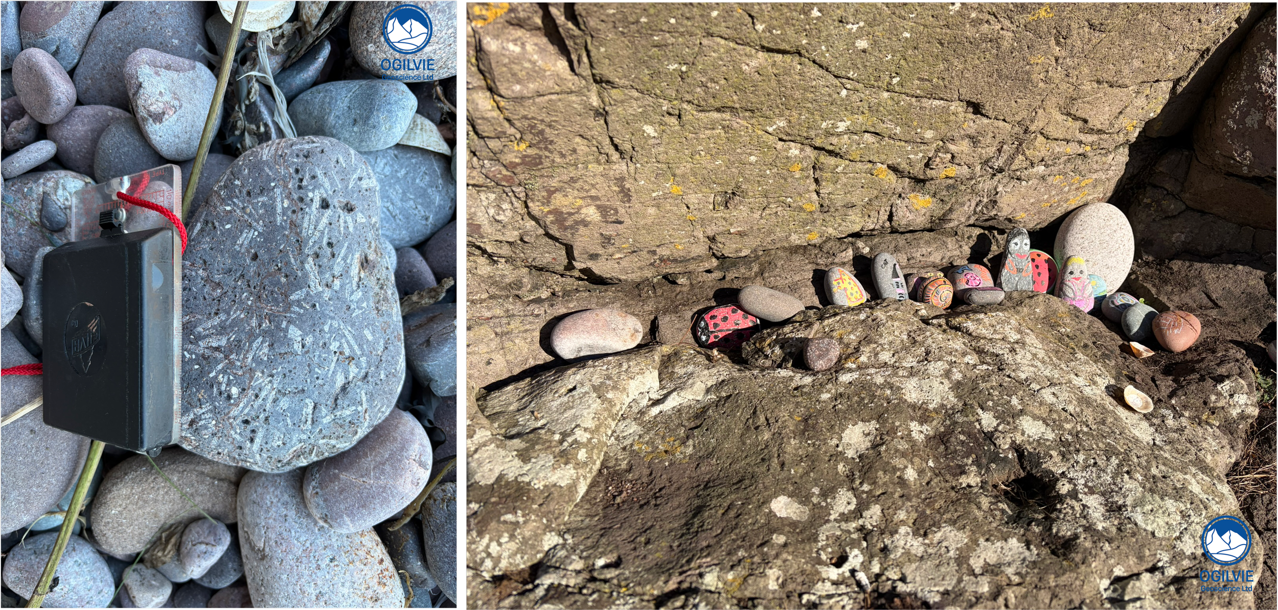
Beach pebble of andesite lava with different phenocrysts and many holes (vesicles) and finally.. on the right
The Way Back
Just follow the route that you took on the way down
Enjoy !
[1] AGS field guide Crawton lavas and Conglomerates of the Lower ORS by N.H. Trewin