
Elephant Drinking in the Sea
An Elephant south of Montrose ?
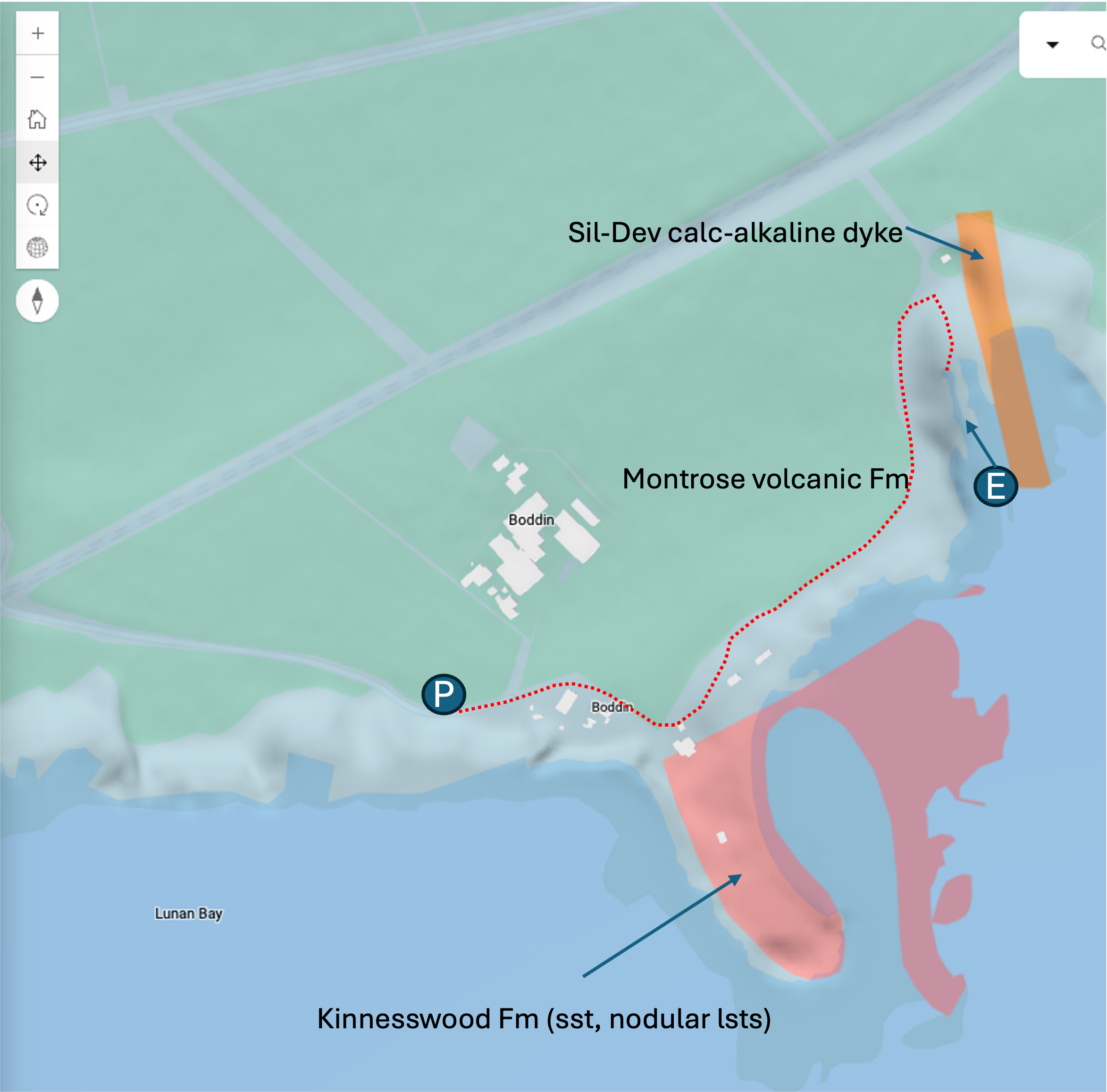
BGS geology viewer showing approx route from parking (P) to Elephant (E)
A well known feature along the Montrose coastline which has formed through volcanic activity and shaped by the action of the waves and tides. Unmissable along the coastal path, a 5- 10 minute walk from Boddin point. Many viewpoints along the path of this elephant coming down for a bit of sea water !
How do I get there ?
From Boddin Point, S of Montrose, Angus. It is possible to park one car next to (but not blocking) the gate at the entrance to the point. The lime kiln is directly seaward of the gate.
Probably better to park in the grassy car park on the right hand side of the single track road on approach to the point (P). You’ll have a few minutes walk along the tarmac past some buildings on your right hand side down to the point. At the point, the Elephant is signposted along a coastal path.
Behind you (on the way) are wonderful views of the limekiln on the point together with the respective Carboniferous limestone that makes up the southern part of it. It takes 5 - 10 minutes to get there and you really cant miss it as the path curves around the headland. There are numerous treaded gaps where you can stop and take in the view.
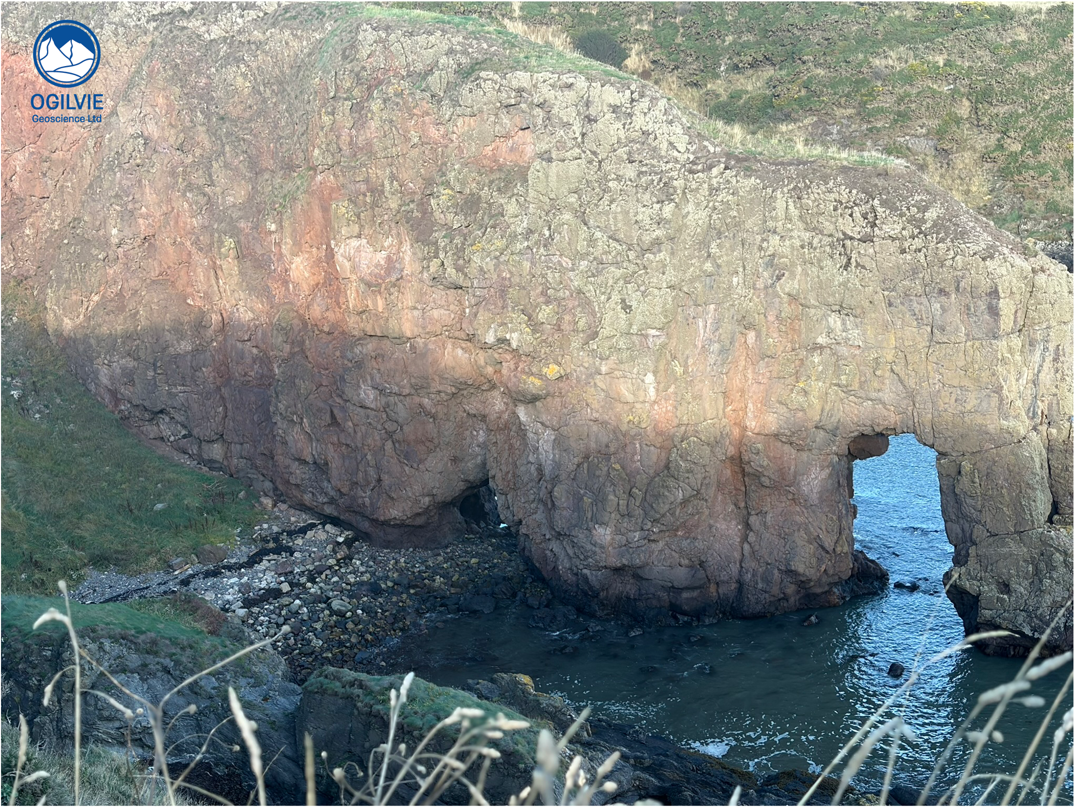
Looking northwards at the Elephant which enters the North Sea just South of Montrose
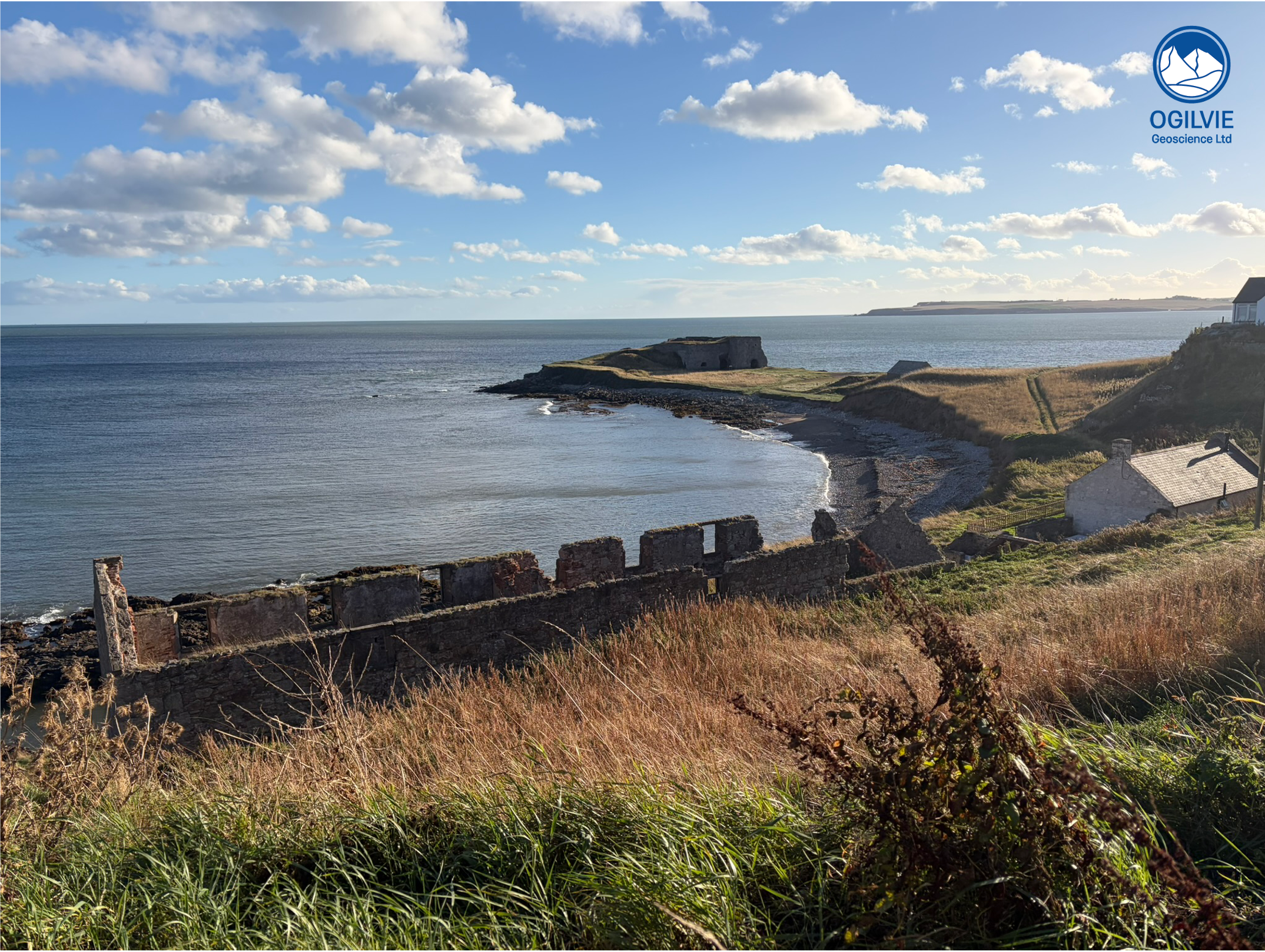
Great view of Boddin Point from the coastal path northwards of the point. The main rock type on the southern shore close to the kiln is limestone.
Up close - pillow lavas ?
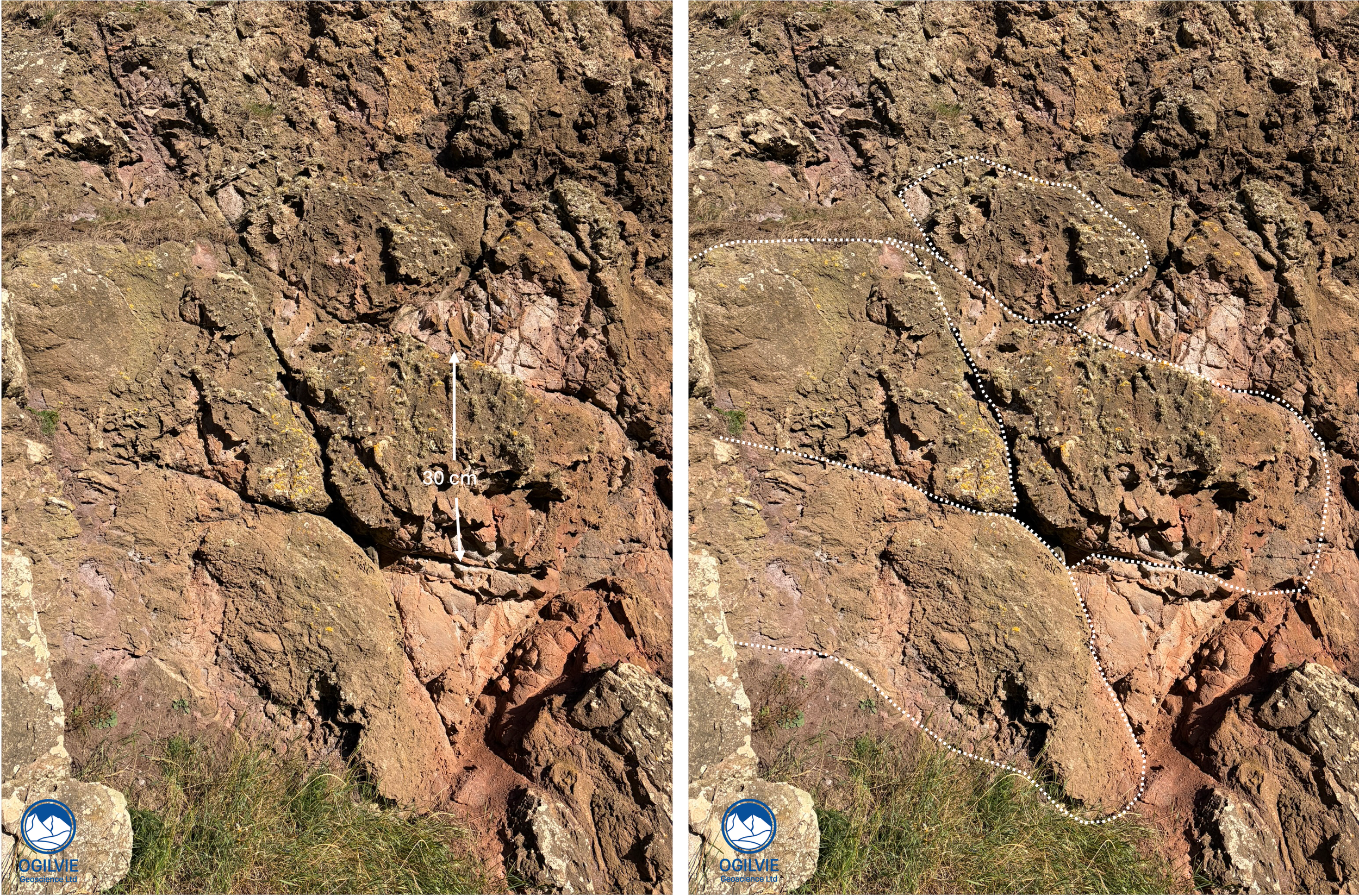
Possible pillow lavas on south facing side of the elephant
Access to the south facing side of the elephant is by a moderately steep grassy gully with a well trodden path. The North side can be reached through the gap next the the elephant’s trunk but it is tide dependant and the rocks are slippy even at low tides. I’ve drawn in what I think are pillow lava shapes in the andesite lava - rather crude but resemble those that have been looked at in detail in the Highland Border Complex at Stonehaven.
I didn’t want to over interpret it but it looks like you could put some fractures in there too at the boundaries of the pillows.
A natural arch
Found in abundance along coastal sections where wave attack zones of weakness - often a fault line or in this case (below) a zone of fractures which are grouped together. Eventually the rocks above the arch will collapse to form a sea stack. This will evolve into a pinnacle where the sea stack gets worn down, often with a pointed top.
Interesting, that there is a curved surface (marked white below) which mimics the shape of the top of the arch below it. So it looks like that could be the new top of the arch in the future. These rocks are very hard so this will take much longer than if we are dealing with a coastline of chalk or sandstone.
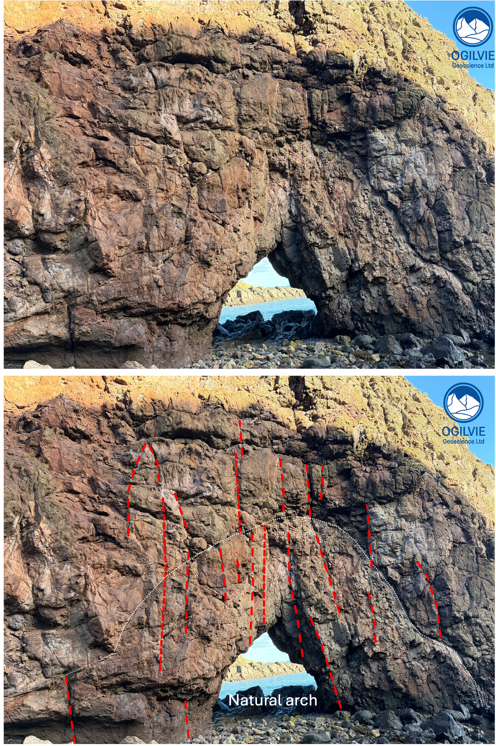
Natural arch has formed by wave action attacking a zone of weakness illustrated here as a fracture swarm. The white line picks out a weak plane about a metre above the top of the arch which will be the top of the arch in the future.