
Drape Folds
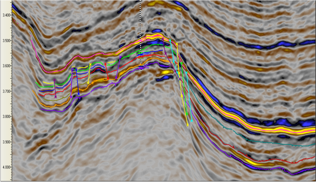
Figure 1. Drape Fold over a tilted fault block - the Rhum Field, Northern N Sea. https://locukltd.co.uk.projects.php#prettyphoto
Drape folds are an important type of oil trap in extensional basins like the N Sea (e.g., Forties Field and Statfjord Field). The sedimentary layers conform to the topography and structure of the underlying basement structures - therefore their shape can be more irregular than compressional folds, being related to fault trends in the basement. An example of a drape fold interpreted on seismic data is provided opposite..
Drape folds can form by differential compaction over basement highs, tilted fault blocks (opposite), carbonate shelf rims or isolated sand bodies in mud. The world’s largest oil field is Ghawar in Saudi Arabia - the oil occurs in Jurassic carbonates draped over and compacted around a north-south trending basement high.
An outcrop example is given below from Kilve Pill along the Somerset coast (England). Here, Jurassic limestones and shales form an alternating, interbedded stratigraphy. The limestones tend to be more fractured (by joints) than the shales creating what is known as a mechanical stratigraphy.
The shale layers drape over a faulted limestone (and underlying shale) block. The fault is clearly dated as pre-upper shale. We would expect the geometry of this fold to conform to the topography of the underlying small fault, and as extensive as the fault itself in map view.
There is a nice example of gouge in the underlying fault zone, together with wedges of calcite cement. Note there is another potential fault zone at the top right of the photo.
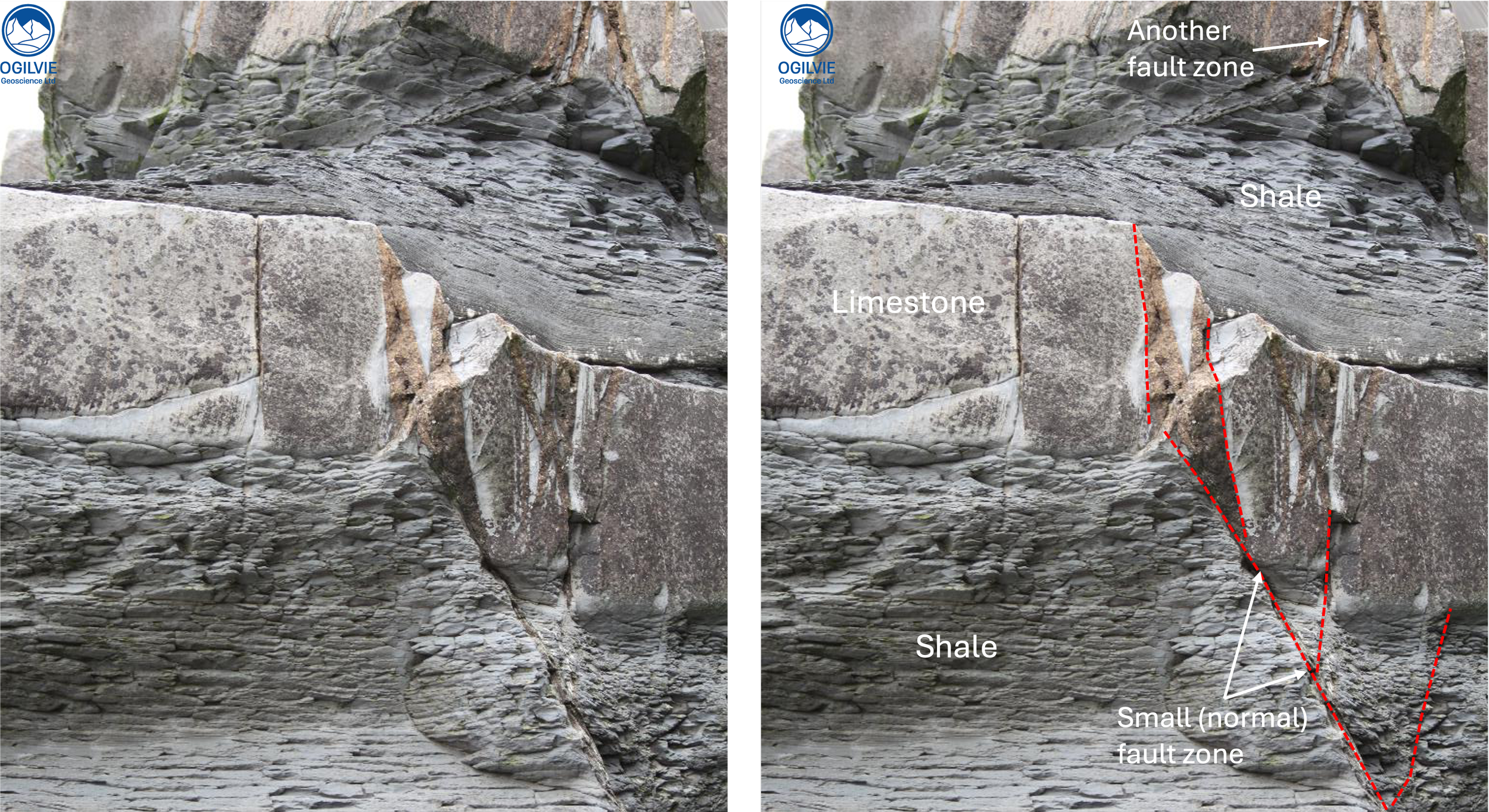
Figure 2. Drape fold caused by the drape of shale over a faulted bed of limestone. Note the brown coloured gouge in the fault together with wedge-shaped calcite cement. Kilve Pill, Somerset, England. Fault throw c . 10 cm.
Selley, R. 1998. Elements of Petroleum Geology. Elsevier, 526 p. 2nd Ed.