

Background
On Sunday August the 30th (2026) I co-led (with Keith Milne) a trip for the Aberdeen Geological Society to a classic locality of Scottish Geology - just North of the Highland Boundary Fault at Stonehaven. Here, we (a group of about 20) had the opportunity to walk Northwards along the coastal exposures of fairly low grade metamorphic rocks through some of the zones of index minerals identified by George Barrow - the so called Barrovian zones.
The occurrence of a new mineral, northwards tells us that we are in a higher (temperature/pressure) grade of metamorphism. The structural geology here is impressive - I don’t like to use the word complicated as that can be instantly demoralising to any conversation, but it takes a while to get your head around what is going on. Essentially, folding and re-folding over a long period of time - the Caledonian Orogeny is thought to span a mind blowing 100 million years ! During this time, various cleavages (often called S1 to S4) have developed, some related to folding (axial planar cleavage).
There is a 15 minutes or so walk from the car park (lay-by) to down under the railway bridge towards the shore. There is a spectacular view of the wavecut platforms of Dalradian rocks to the North and East - which look like they are dipping to the NW, although this is likely to be a mixture of foliation and bedding of these meta-sedimentary rocks. To the South, the headland of Garron Point picks out the rocks of the Highland Boundary Fault as they head northeastwards into the North Sea.
We followed a path up past some concrete (probably from WW2) blocks down onto the foreshore for the first stop - where Dalradian grits (psammites) and finer grained meta-sediments (pelites) extend as rocky exposures from the foot path area into the sea.
Shackleton’s exposures
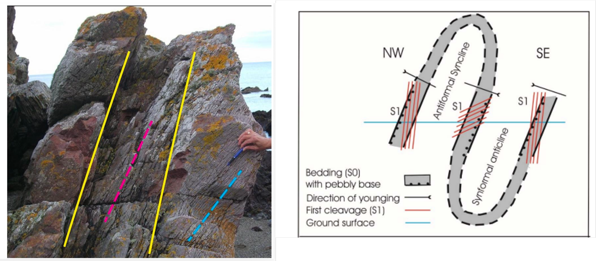
Shackleton’s exposure from the AGS field guide and interpretation of inverted structures.
We discussed the fact that rock layers will young towards the centre of synclines and outwards from the centre in the case of upfolds or anticlines. However, full fold forms (with hinges, closures) are not common in this area - in contrast there are some nice folds in all their glory in neighbouring Craigeven Bay to the South of Skatie Shore. Therefore, we need to use fold axis vs. bedding (dip) relationships to understand where we are on a fold - perhaps a steep limb compared to a more gentle limb opposing limb. The way to find out of (at least some of) these structures are inverted (turned upside down) is to check for evidence of “way-up” from original sedimentary structures - chiefly graded bedding and cross-bedding. The example is a syncline that has been inverted into what is now an antiformal syncline - we know this as the structure youngs inwards as shown by the distribution of graded beds (opposite).
We walked a short distance over these exposures northwards to another example of an inverted structure. The bedding is easily picked here as the relatively softer pelites have been hollowed out by the elements to expose the bedding planes at the boundary between the pelites and psammites. Here, we could see some later folding on the flanks of the structure and some folks picked out some possible strike-slip faulting impacting this structure.
On the way northwards to twin rocks, we stopped to look at some clean exposures on the lower beach. Quartz veins which are parallel to bedding appear to have been sweated out of the meta-sediments during burial. Sometimes it was a bit tricky to distinguish original cross-bedding from simply a refraction of cleavage into different rock types.
Twin Rocks
About half way along Perthumie Bay, these rocks stand proud of the WCP and are reached by a bit of a scramble across fairly slippery rocks. Here, we could see various cleavages (S1 -S3 and perhaps S4) and rather chunky quartz veins that often wind their way through the host meta-sediments. Bedding (S0) can be picked out by the softer meta-pelite layers. The twin rocks sit in the core of what looks like a large fold on aerial images. It is possible that they are marking the spot of an underlying thrust fault which has become cemented and therefore resistant to erosion.
Graded Bedding
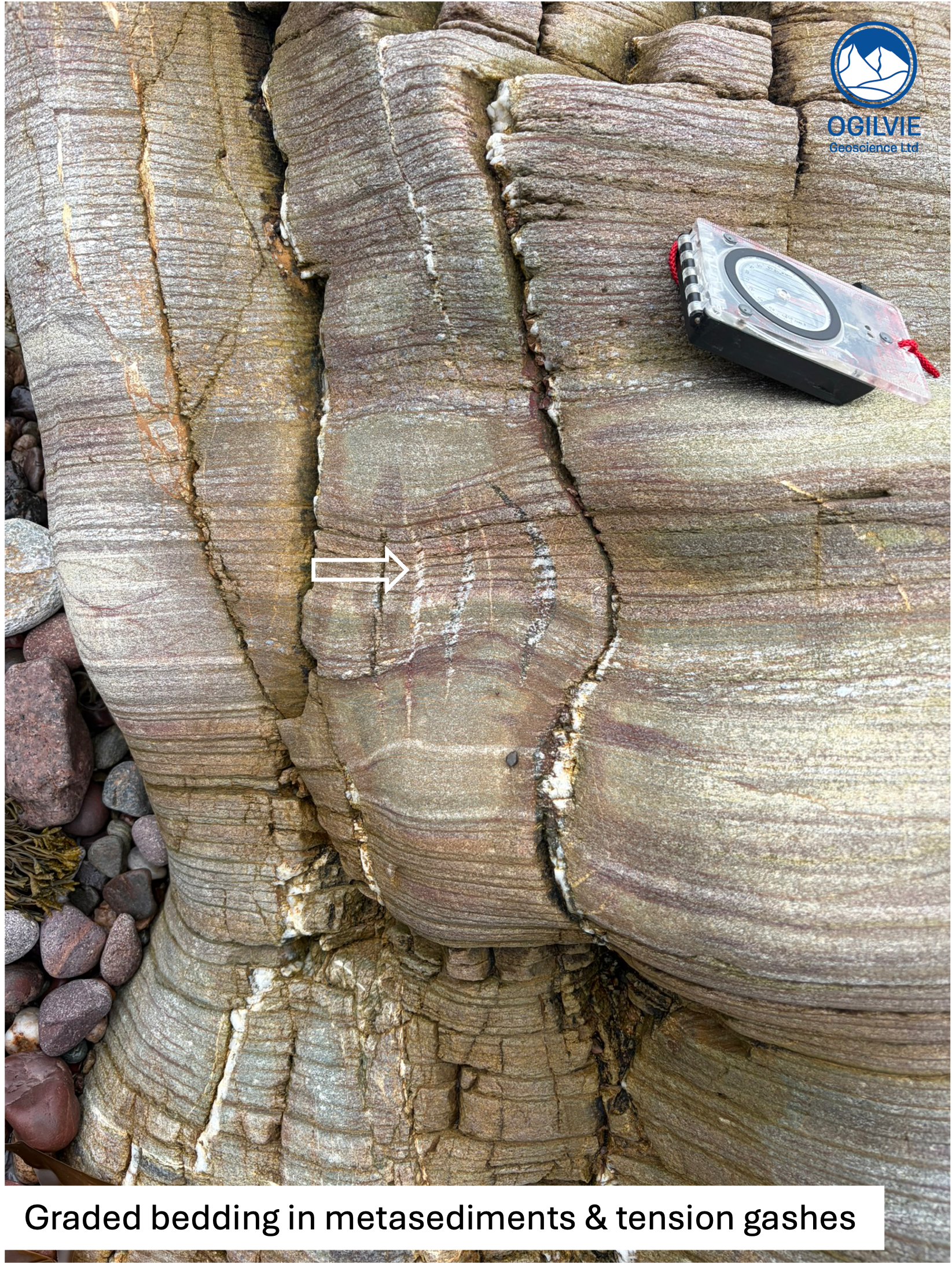
We continued along the storm beach to a series of fairly clean outcrops of colour banded meta-sedimentary rocks. The outcrops at the far end show the best examples of graded bedding (cycles can be few 10s of cms) and also small channels cutting down - all evidence of way-up and these are the correct way up in this area. Also, we spotted some tension gashes (opposite), evidence of expected extension episodes within the rather lengthy Caledonian Orogeny.
Folding at Red Man
We weren’t sure what “red man” refers to - maybe it’s the more reddish coloured pelites that can be found here or perhaps the fact that garnets start to appear in the rocks. Anyway, a good place for lunch !
An obvious fold is found at the end of the bay. It has a tight fold hinge, most likely from stage D1 and appears to have had a few episodes of refolding. We also spent a bit of time looking at these tight pygtmatic folds (title pic) in a boulder that has likely been brought here by ice travel during the last ice age.
Flat lying rocks - Box Fold ?
At the next headland, the layering or cleavage is quite flat, leading us think that this is a large box fold - informed by the fact that box folds are recorded as part of D4 in other locations along the Highland Border. One participant pointed out a minor “Z” fold which has a kink band type hinge (below). These are useful to understand the vergence of larger structures. Such small folds are often called parasitic folds.
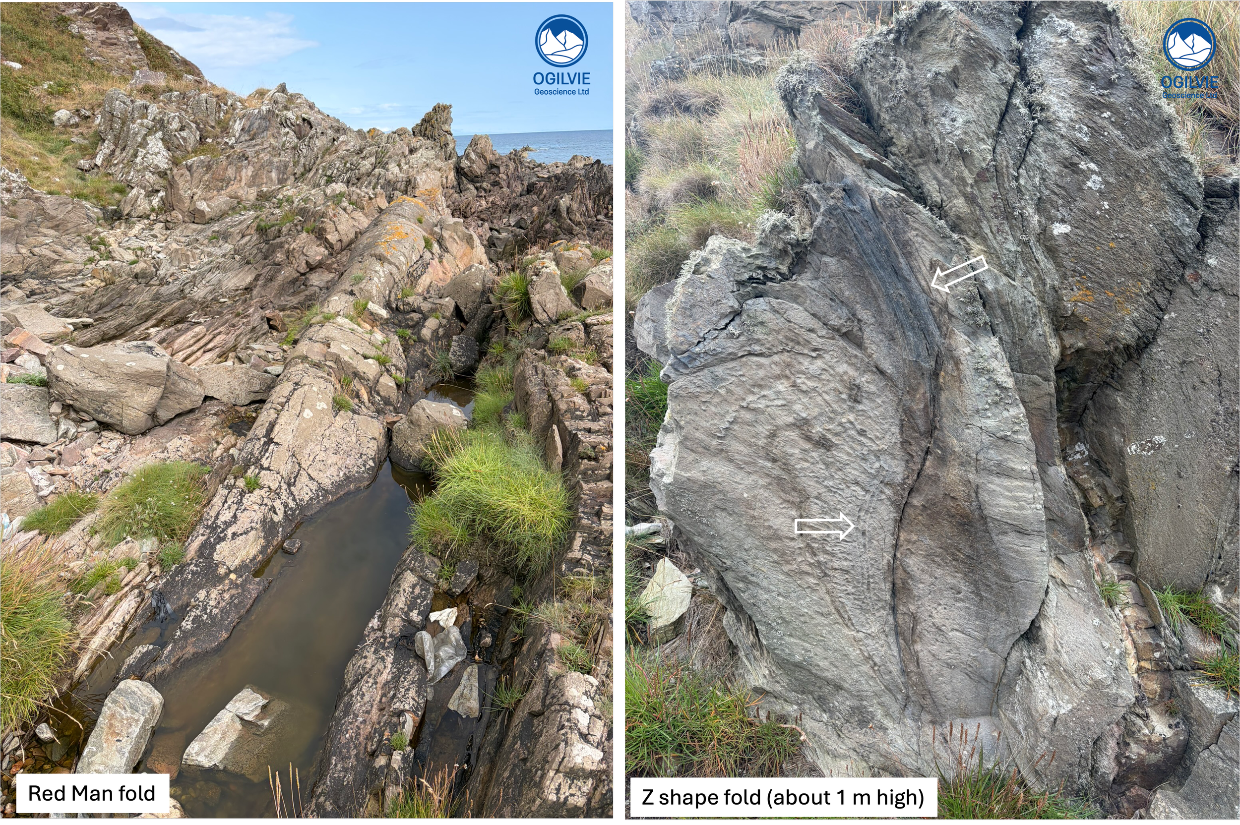
Various folds found along this coast
Garnet and Staurolite Minerals
We found many red garnets in the pelites (opposite) on the bay just North of this headland. A short distance (minutes) from these exposures folks were noting the occurrence of light brown coloured staurolites, often a similar size to the garnets. This change over a short distance tells us that the grade of metamorphism is higher.
We re-traced our steps along the storm beach and stopped at some of the exposures we’d already seen to look at them again. We were back at the car park by about 3.30 - 4 p.m. The AGS guide extends the trip out to Muchalls to the North but that’s for another time.
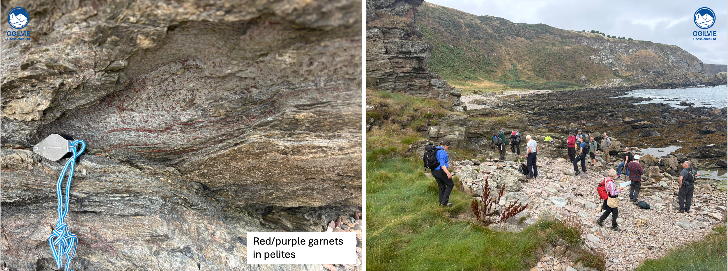
On right hand side, the group at the flat bed locality