
Strathmore Syncline, Midland Valley, UK
What are Synclines ?
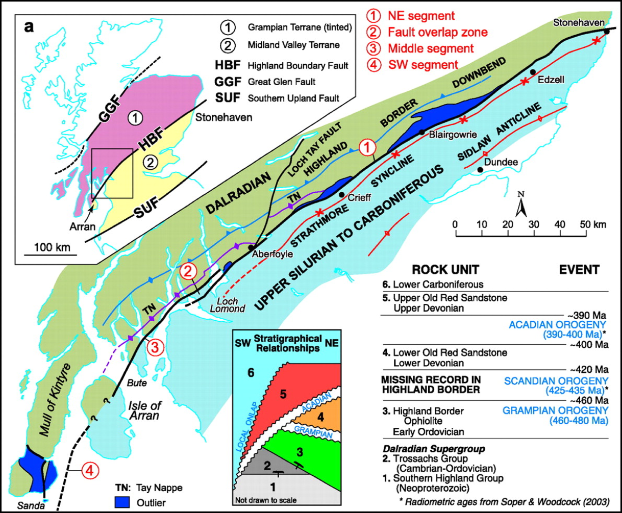
Map showing the extent and NE-SW trend of the Strathmore Syncline - from Stonehaven on the East coast down to the Loch Lomond area (Tanner et al. 2008)
Saucer shaped folds that form as a result of tectonic compression. Often they are symmetrical in that the opposing limbs dip at approximately the same angle. Asymmetrical structures are also common where one limb has a steeper dip than the other. The younger rocks are exposed in the cores of synclines.
The Strathmore Syncline
Our example here, the Strathmore Syncline is aregionally significant feature running from just South of the Highland Boundary Fault (HBF) at Stonehaven southwestwards to Loch Lomond. It is an example of an assymetrical syncline as one limb (the northern one) is steeper than the other (southern). It was formed during the Middle Old Red Sandstone (ORS) around 400 Ma during a young stage of the Caledonian Orogeny called the Acadian Orogeny.
At Cowie shore (Stonehaven) the Lower Devonian sedimentary rocks (Strathmore Group - Sil-Lower Dev) dip from around 80 degrees (to the SE) to being nearly vertical in places. The steep beds on the wave cut platform have been extensively eroded and are best preserved at the end of the Cowie section on cliff sections (below …)
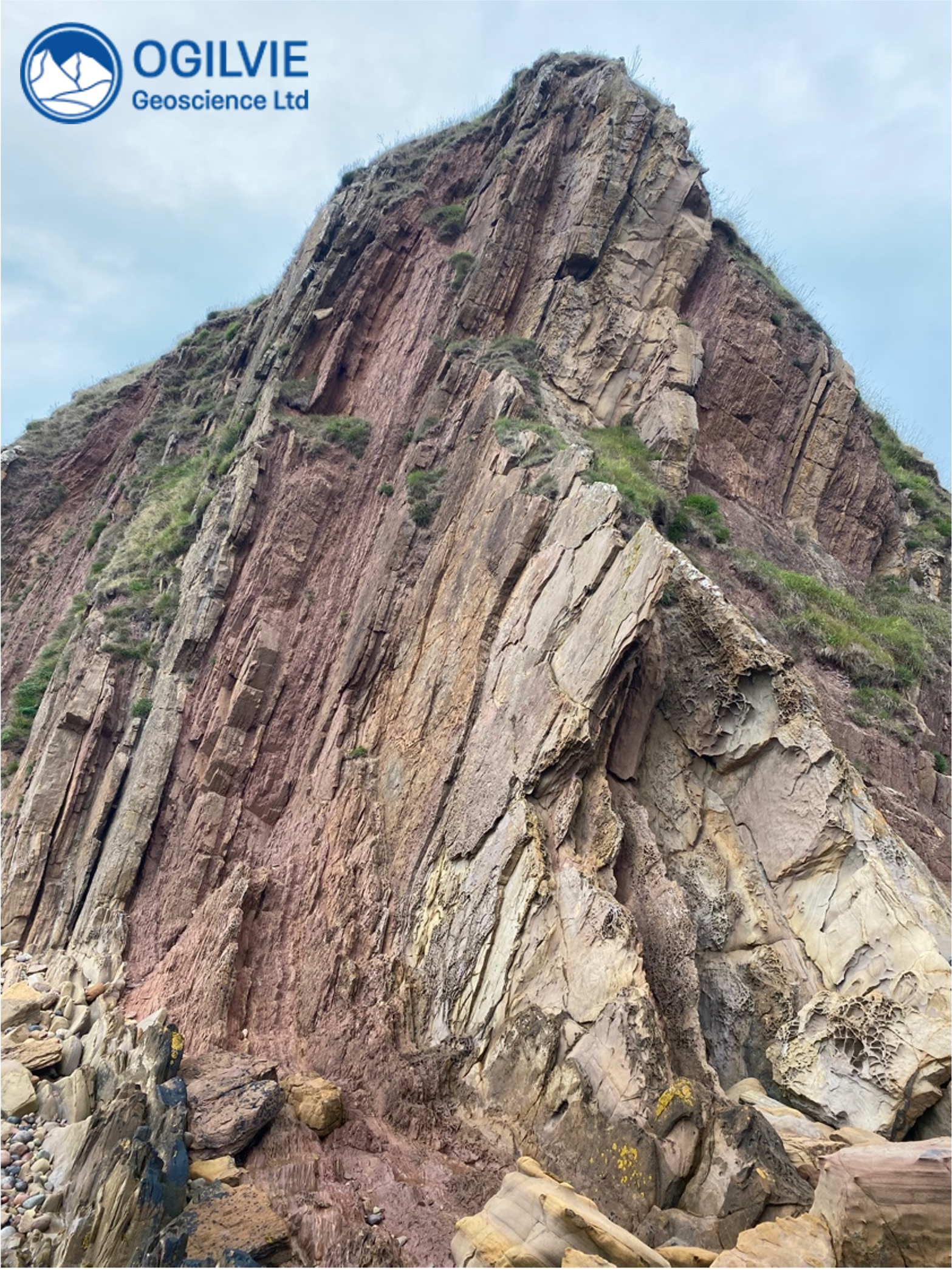
Steep beds of the Strathmore Syncline as seen from the foreshore at Cowie
Igneous Dikes
As you follow the steep beds northwards along the shore, you will come across a different rock type - a much darker igneous rock which is not bedded (unlike the sandstones). This quartz porphyry has been intruded into the sandstones in the form of an igneous dike.
These dikes run from left to right across the steep beds and are best seen from the top of Stonehaven Hill - notice the major break in the foreground of the view below. The steep beds of the syncline are on the north side and the main dike with a distinctive seaweed cover on the south side.
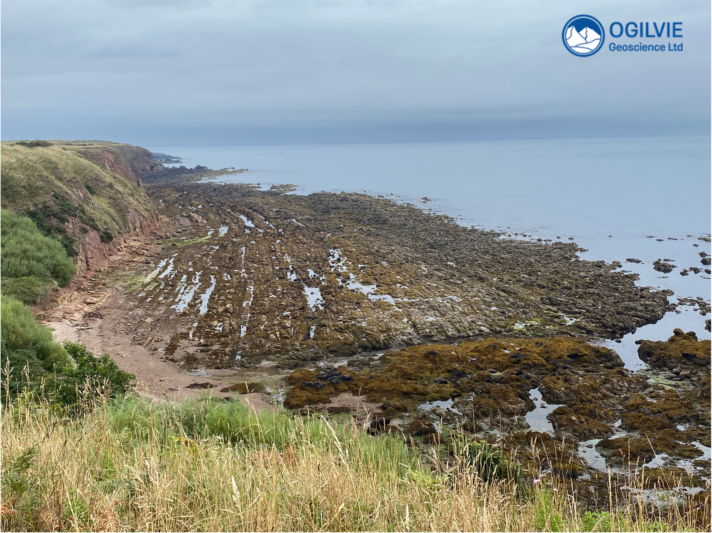
View of the steep beds of the north limb of the Strathmore Syncline from Stonehaven Hill - looking Northwards.
These dikes are certainly younger than the Lower Devonian sedimentary rocks - but how much younger ? It is possible that they are of Tertiary age and have been introduced during opening of the modern Atlantic Ocean.
Looks like these holes in the rock are small plugs taken for some core analysis - maybe a student project ?
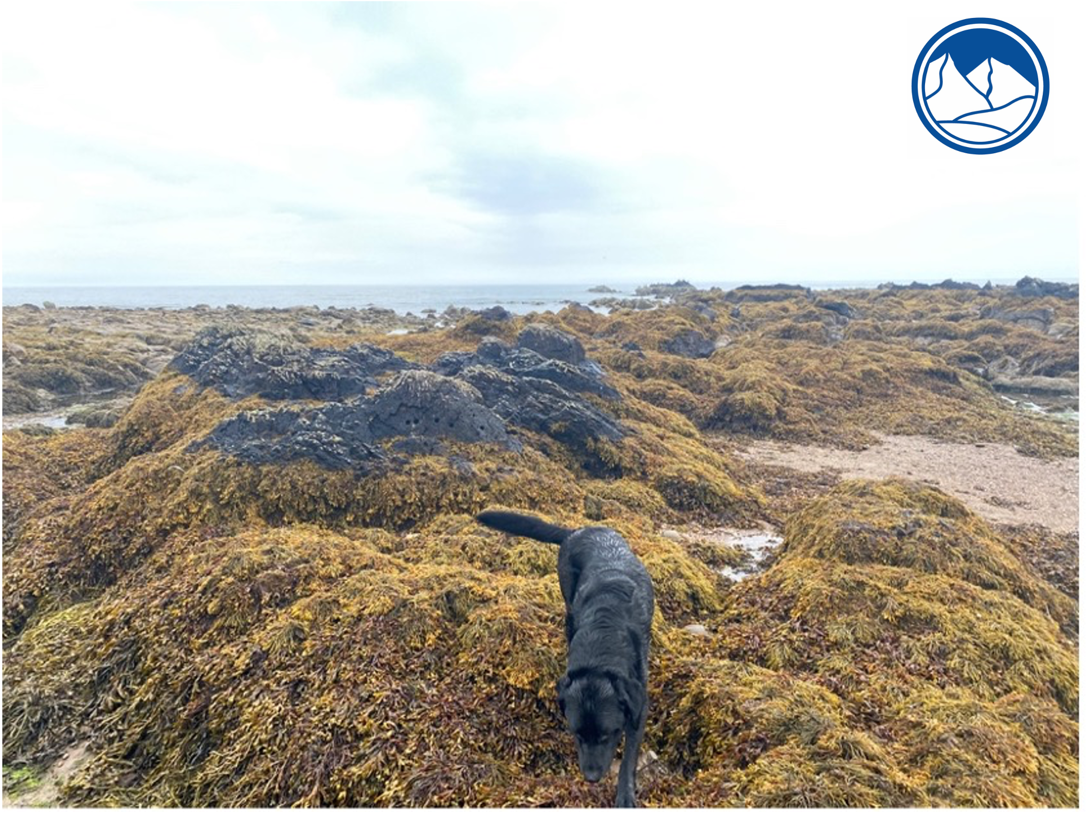
Seaward view along one of the igneous dikes
Tanner, G. 2008. Tectonic Significance of the Highland Boundary Fault, Scotland. Journal of the Geological Society, 165, 915-921.