
Geology of the Highland Boundary Fault Zone - an EAGE trip
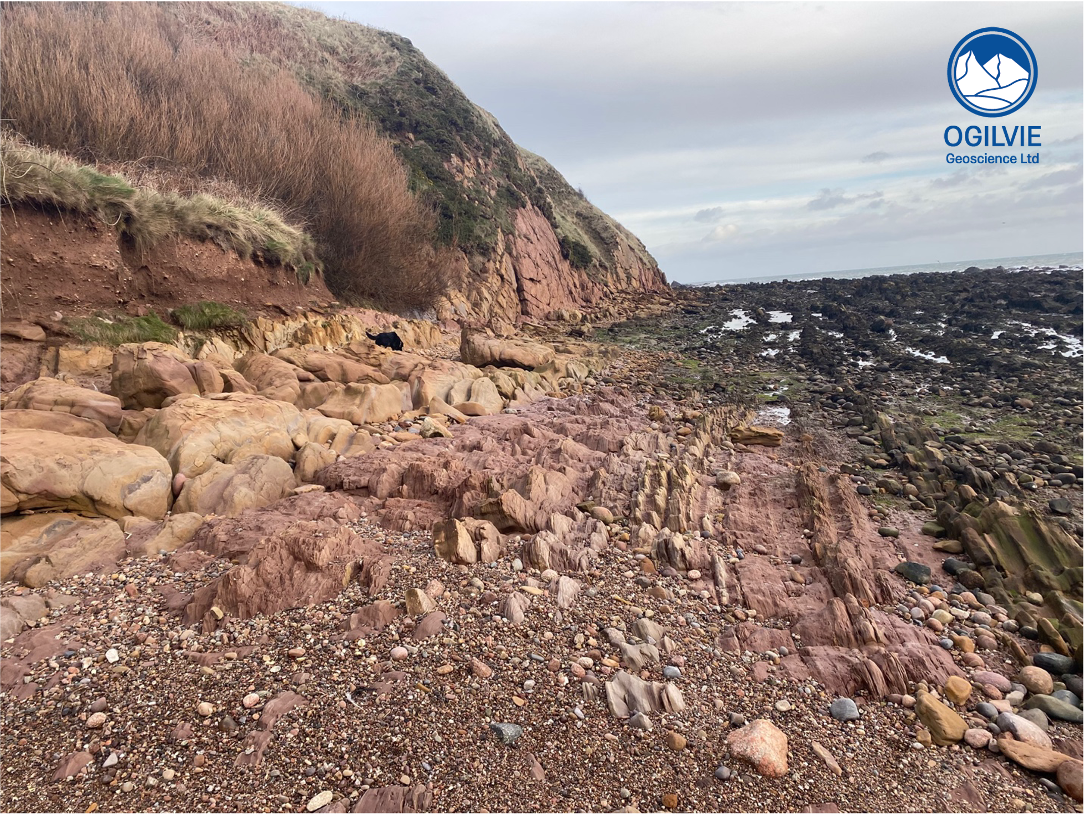
Steeply dipping beds of the Strathmore Syncline on Cowie shore
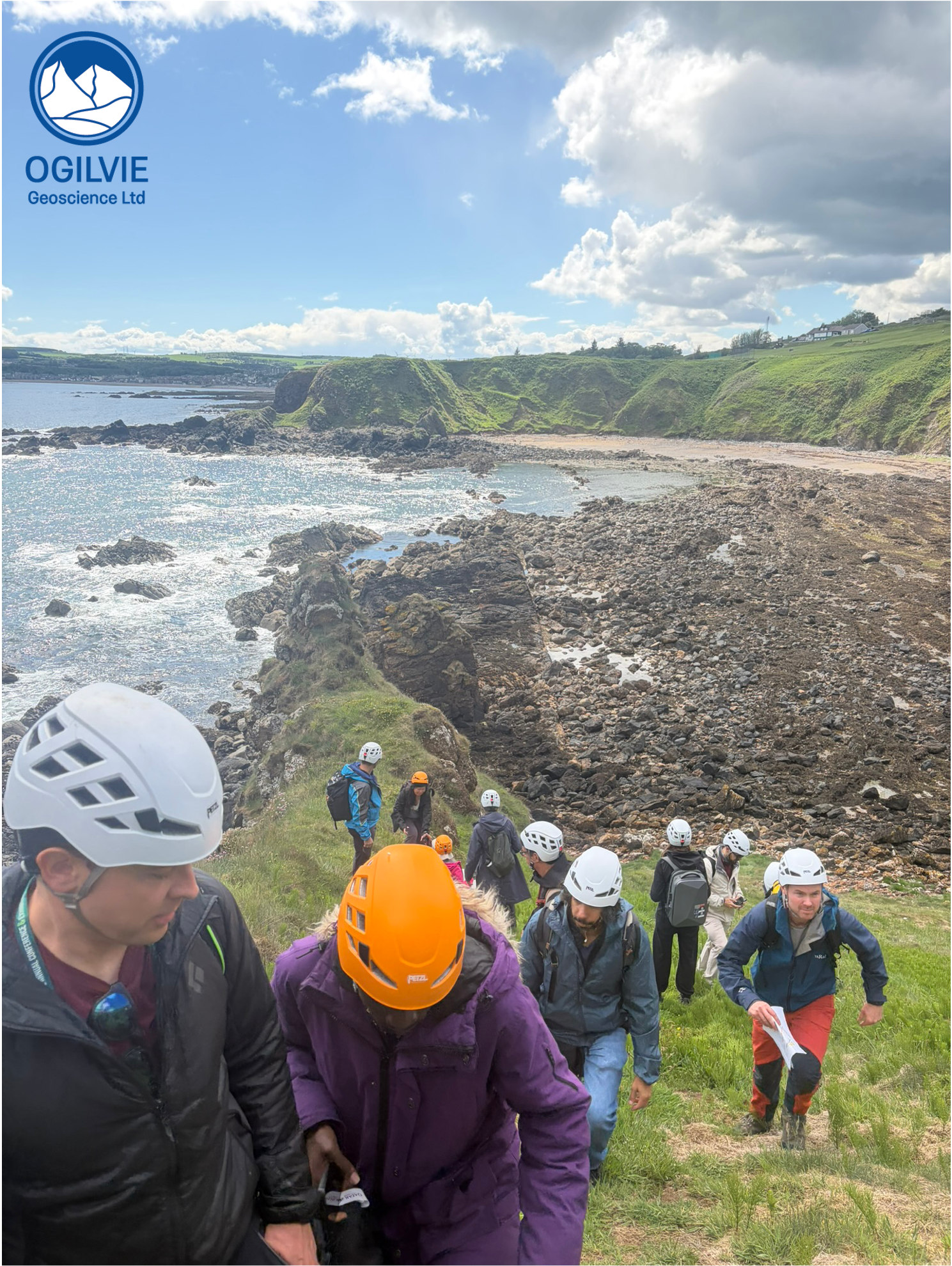
On Monday 8th June I co-led a trip to Stonehaven as one of several trips offered by EAGE during their annual conference in Aberdeen 2026. Myself, Marcus Duffy and Mike Schiltz led a group of 20 folks with diverse backgrounds in geology and engineering on a walk across the Highland Boundary Fault (HBF) Zone just north of Stonehaven. Our walk took us from the Devonian sediments of the Midland Valley, northwards across the various fault rocks of the HBF and onto the Dalradian age meta-sediments of the highlands just north of the HBF. The bus dropped us off at the leisure centre and we walked (about 10 minutes) to locality 1 at Cowie shore..
The Old Red Sandstone
Dominated by sandstones and mudstones of the Devonian period, the ORS also includes Late Silurian and Early Carboniferous rocks. In fact, the sedimentary rocks, deposited by braided streams (semi-arid) on Cowie shore are dated as Wenlock (Late Silurian). The beds are no longer horizontal as have been steeply tilted (towards the SE) by compressive stress during the Caledonian mountain building period (known as an orogeny). We are treading on the eroded steep beds of the Strathmore Syncline which runs parallel to the HBF (on it’s south side) for a few 100 km. Prior to tilting, these sediments have been deformed by liquefaction when the sediment loses it’s strength due to water influx and gets all shaken up by earth tremors.
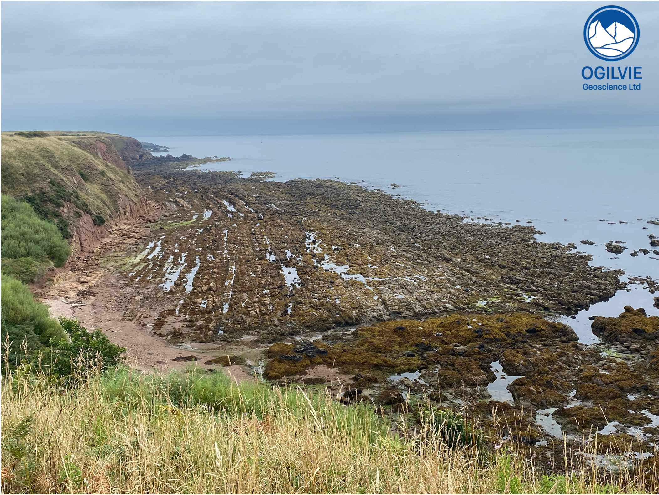
Steep beds of the Strathmore Syncline - view from Stonehaven Hill
Igneous Intrusions
The steep beds are cross cut by igneous dykes probably of Carboniferous age - the best view of one of those is from Stonehaven hill (opposite). These features are covered by seaweed in the foreground. The rock type is a quartz porphyry with particularly big crystals of feldspar. We can call this a felsic intrusion at the acid side of the igneous spectrum - different to darker, mafic intrusions, found at other places along this coast - which are dominated by minerals such as pyroxene and hornblende.
Pillow lavas and Highland Border Complex
A short walk (northwards) across the bay at Skatie Shore we came across a very different rock type to the sandstones and mudstones seen so far. These highly altered rocks look in part to be highly brecciated and don’t show any signs of bedding. In fact it looks like there is a cleavage that dips to the NW in the opposite direction to the steeply dipping (to the SE) sedimentary rocks of the ORS. Just round the corner across slippery boulders, the presence of lavas that have erupted underwater is a clear sign that we are looking at the site of an ancient ocean - the Iapetus Ocean. At Stonehaven, the pillows are not always that convincing and have been highly altered. It is more the association of rock types and structures that lead us to this intepretation of ocean floor deposits. The so called Highland Border Complex contains pillows as well as cherts and dark mudstones. Better examples of pillows can be found in SW Scotland (below).
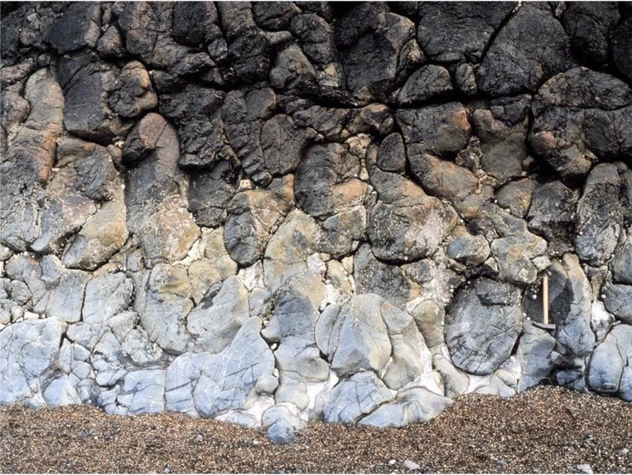
Pillow lavas (upper) just north of Stonehaven and (lower) Downan Point lava formation, south of Ballantrae. From Andrew McMillan.
The Dalradian
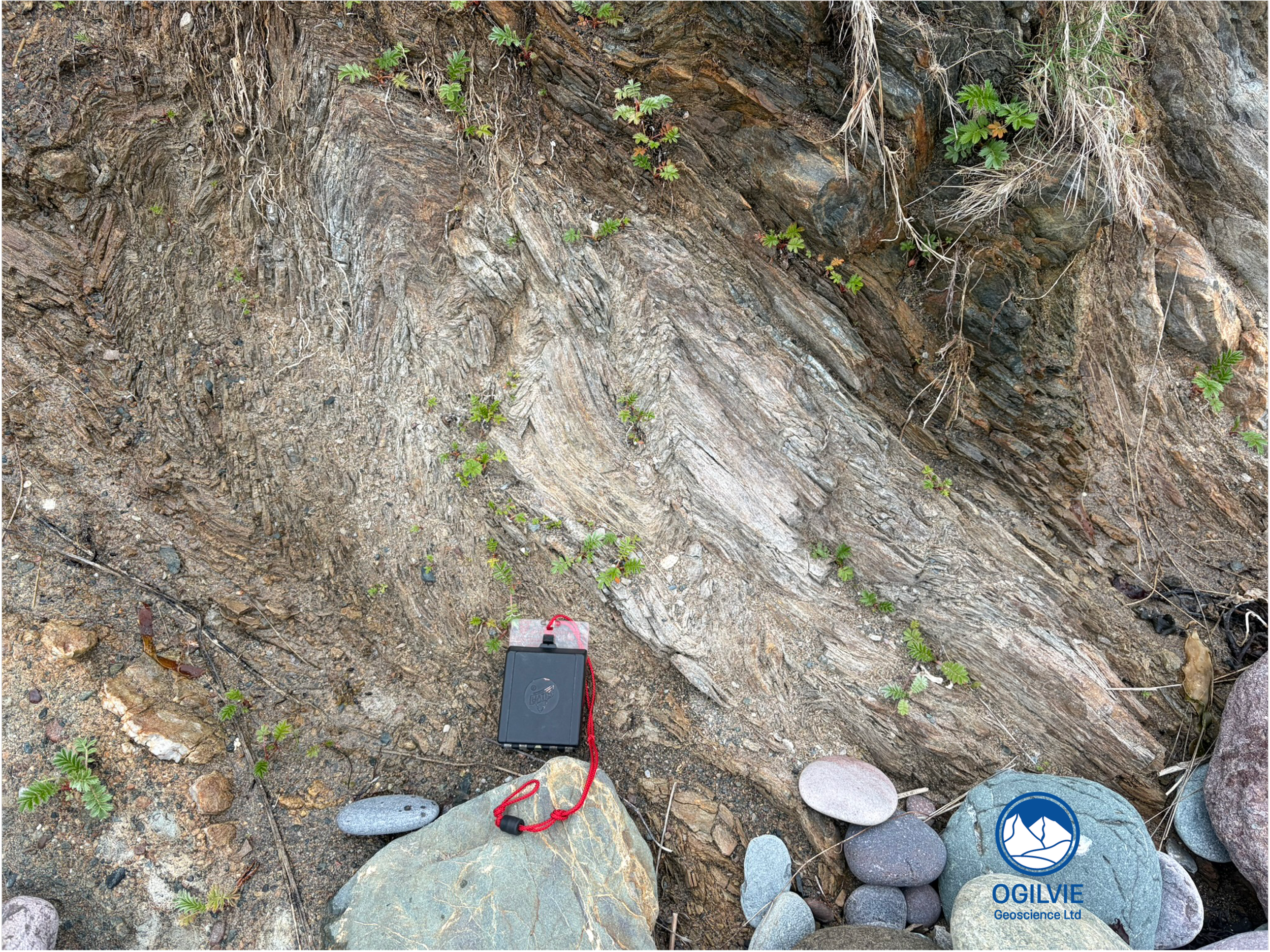
Kink bands in phyllite at the back of Craigeven Bay
After lunch, we stopped by the cemetery in front of the golf clubhouse to have a look at the metamorphic rock schist on the walls of the chapel ruin. A nice opportunity to compare this to the sandstones and granite gravestones that dominate the cemetery. A short walk along the edge of the golf course to hole #2 - called Willie’s Fault presumably related to his golf skills but also giving superb views across Craigeven bay along the outcrops of the Highland Boundary Fault. Its a bit of a slippery drop down into the bay as there are active landslips. The plastic pipe in the upper part is there to drain off the water but it’s a bit counterproductive as provides water to the slipping soil/rocks. The rocks of the HBF sit underneath these landslips.
It was worth it getting down (slowly) into the bay as there are are some spectacular folds in the Dalradian phyllites. Tight ‘V’ shaped folds known as Kink bands (like those below) are common in low grade metamorphic rocks such as phyllite. There are also layers of gritstone - a metasediment that wasn’t buried deeply enough to be subjected to the same temperatures and pressures that schists and gneisses have experienced further north in the Grampian highlands. Veins of quartz run parallel to the original bedding.
Highland Boundary Fault
The best views of the fault were looking behind us (to the south) on the way up the hill on the south side of Craigeven Bay. The fault plane runs clearly along the beach to the plastic outflow pipe at the base of the landslide that we descended to drop into the bay. One of the particpants pointed out another line of rocks in the water just to the right hand side of the fault plane - one of the key takeaways was that faults are not single planes but are parts of zones which contain fault rocks and other faults.
The group climbing up the hill at the south end of Craigeven Bay with view of the fault plane behind
After getting to the top, we made our way the short distance to Garron Point where the fault rocks head out into the North Sea. Here we took a look at an old PESGB structural map to trace it onto the Peterhead ridge and beyond. Recent work suggests that it was also reactivated in the Permo-Triassic. So this major fault has had quite a few episodes of movement (reactivation) and the story keeps evolving.