
Devonian fish-bearing nodules, Moray, Scotland
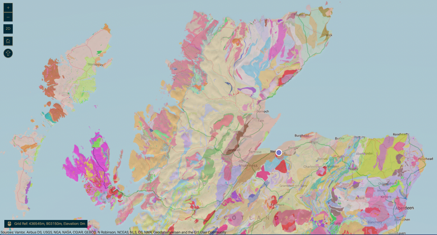
Geology map from BGS (geology viewer) showing general location by blue dot
Location in Scotland
Close to the village of Auldearn with views of the Moray Firth. You can reach this area off the A96 from Forres to Inverness - you’ll need to get permission to visit the quarry in the grounds of Lethen House and then from the farmers for the other 2 (Clune and Lethen Bar). It took us 3 - 4 hours to get round these 3 locations.
What are we looking at ?
A series of disused quarries, only 1 of which has an outcrop but all are of historical significance. Lethen House Quarry is an important but under appreciated locality for collecting Devonian age fossil fish from the sedimentary rocks present in the outcrop.
The quarried rocks were sandstones for buildings/construction and also limestones for use in local limekilns for producing quick lime to be spread on the fields with an aim to increase productivity.
Geology
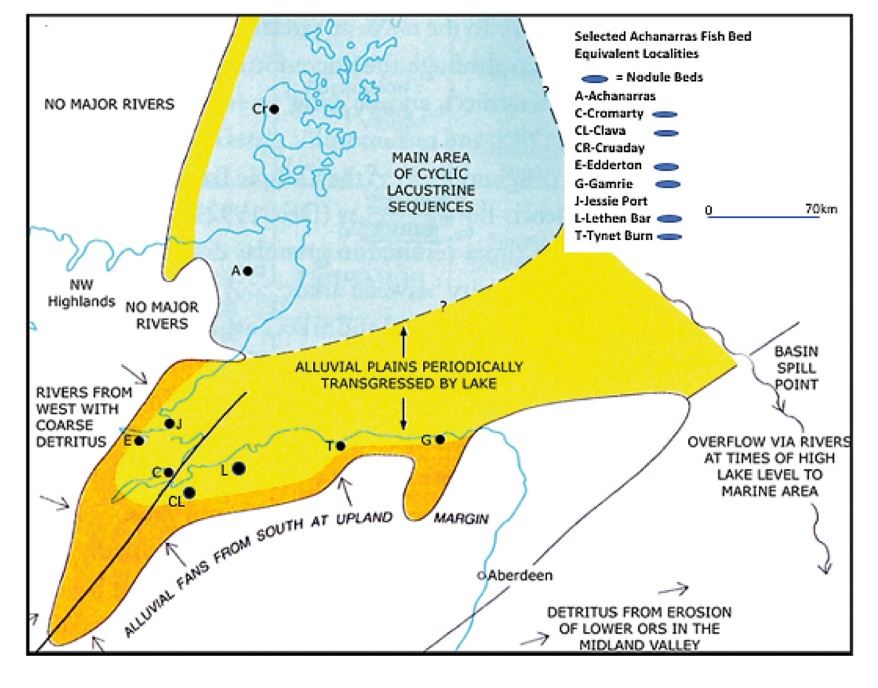
Depositional environments of the Lower Devonian in the Inner Moray Firth area. Lethen Bar visited on this trip is shown by L next to black dot
Lower Devonian sedimentary rocks of the Inverness Sandstone Group (ISG) which form the basal sequence of the Devonian on the SE side of the great Glen Fault. These are mainly river (fluvial) deposited during the lower Devonian period, although some sediments can be interpreted as having been deposited in a lake setting - likely when the Orcadian lake (N Scotland) or related lake transgressed this river environment. These lake sediments can be called lake-margin.
Within the ISG there are 5 formations; The oldest is the Daviot Conglomerate Formation which rests on the eroded/worn down metamorphic and igneous rocks of the Caledonian Orogeny. Younger formations such as the Nairnside Sandstone Formation contain red and green muddy sandstones (often rich in feldspar = arkoses) that contain fish remains and silty limestone nodules.
Quarry and exposures at Lethen House
Plant material is abundant here and is best collected from the floor area, not from the exposures themselves ! The fossil below is very impressive - you can see the full branching structure of the plant. The nodules (at least some of them) are fish bearing [1]. When we visited, we found plenty nodules that had fallen off onto the old quarry floor - but no fish - although I picked up one with an impressive calcite fibre rim. Other nodules do not have that characteristic rim.
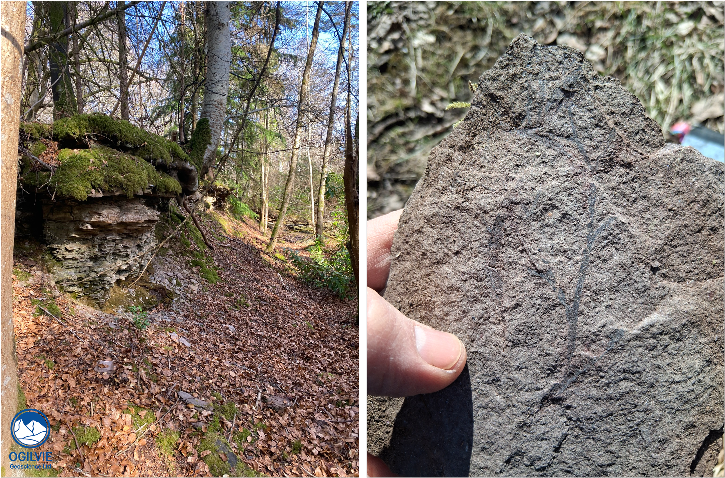
Exposure of sedimentary rocks and a plant fossil collected at Lethen House quarry (from Danny Long) from the floor area.
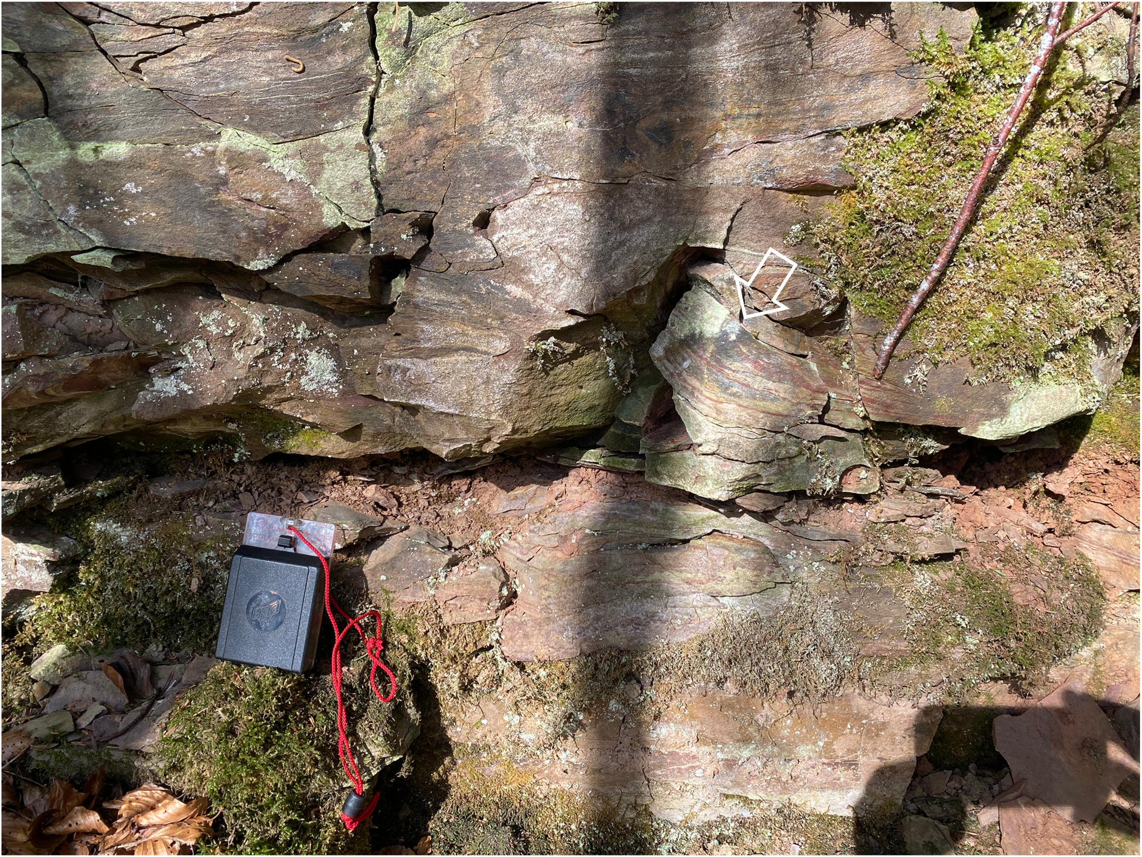
The best exposure of Lower Devonian geology in this area is at Lethen House Quarry - accessed by a walk along the Muckle Burn. It is not a Site of Special Scientific Interest (SSSI) but permission for any geological excursions is needed. This exposure is 1.5 to 2 m high and has been split into 3 units [1].
Top unit has fossil plant debris
Middle unit (around 70 cm thick) is shale with laminate nodules which sometimes have fish remains - theres a good example in ref [1] below
Bottom unit (around 70 cm thick) of fine grained sandstone with fossil plant debris. This overlies a coarser sandstone with pebbles which is not exposed here.
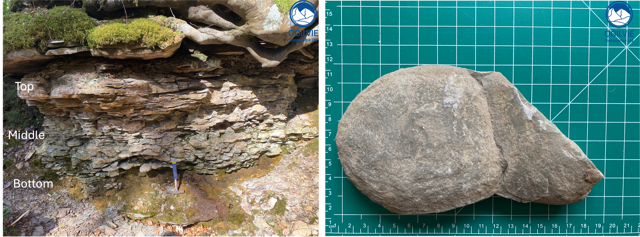
Eroded face of Lethen fishbed - unit subdivision by Davidson et al [1]. Note the in-situ nodules. Typical flat nodule which could be fish bearing on the right.
Structural Geology
There is some structural geology here too ! Further along the exposure there are some small folds in the more muddy units which have probably been caused by slumping of the various sedimentary bedforms. We didn’t see any shear fractures/faults but as usual there are plenty extensional fractures (also called joints) which have probably formed due to unloading.
A cross section through the 2012 geological map of the area (BGS) shows Lower Devonian sediments within fault blocks. The faults are rather steep here probably because of some vertical exaggeration on the section. The main fault trend is approx NE-SW which follows that of the Great Glen Fault (off the map to the left) suggesting that they may be related to later movement on this fault.
Folds & contortions in the muddy rocks at Lethen House exposure which likely have formed through slumping
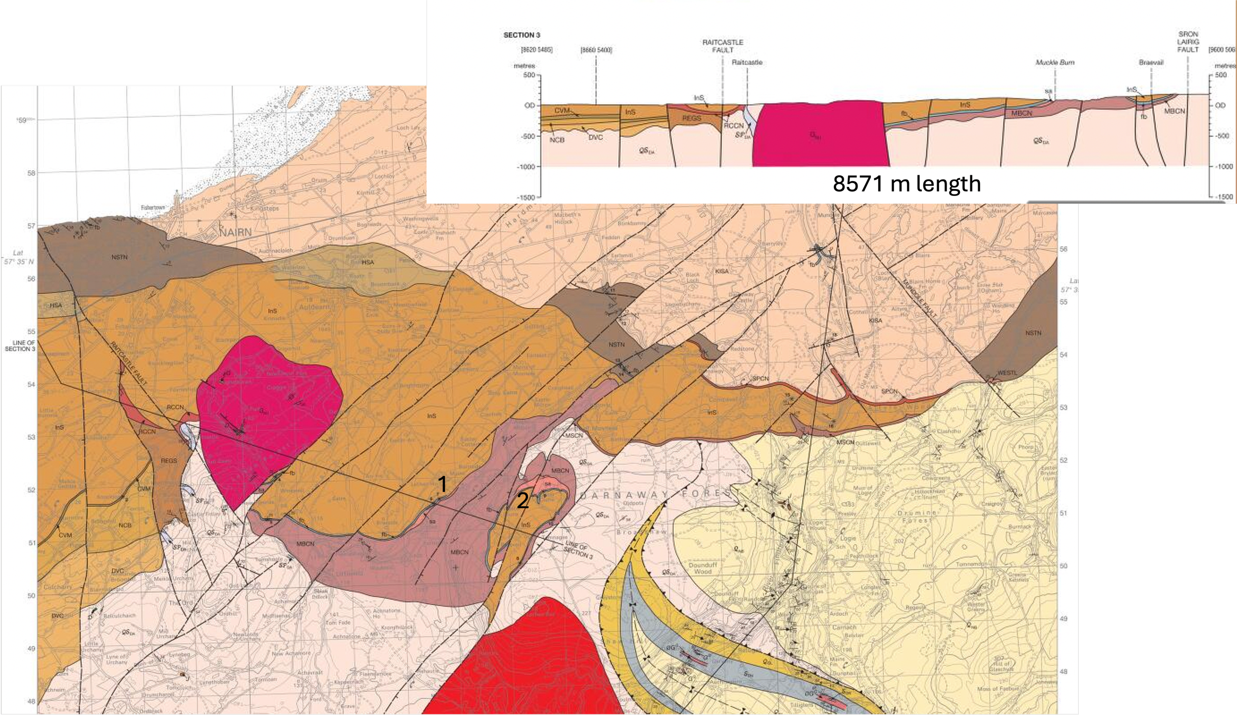
1:50000 geological map (BGS from 2012) of the area showing the areas visited (1, 2) just south of Auldearn. The cross section is line of section 3 which goes through areas visited.
Lethen Bar Quarry
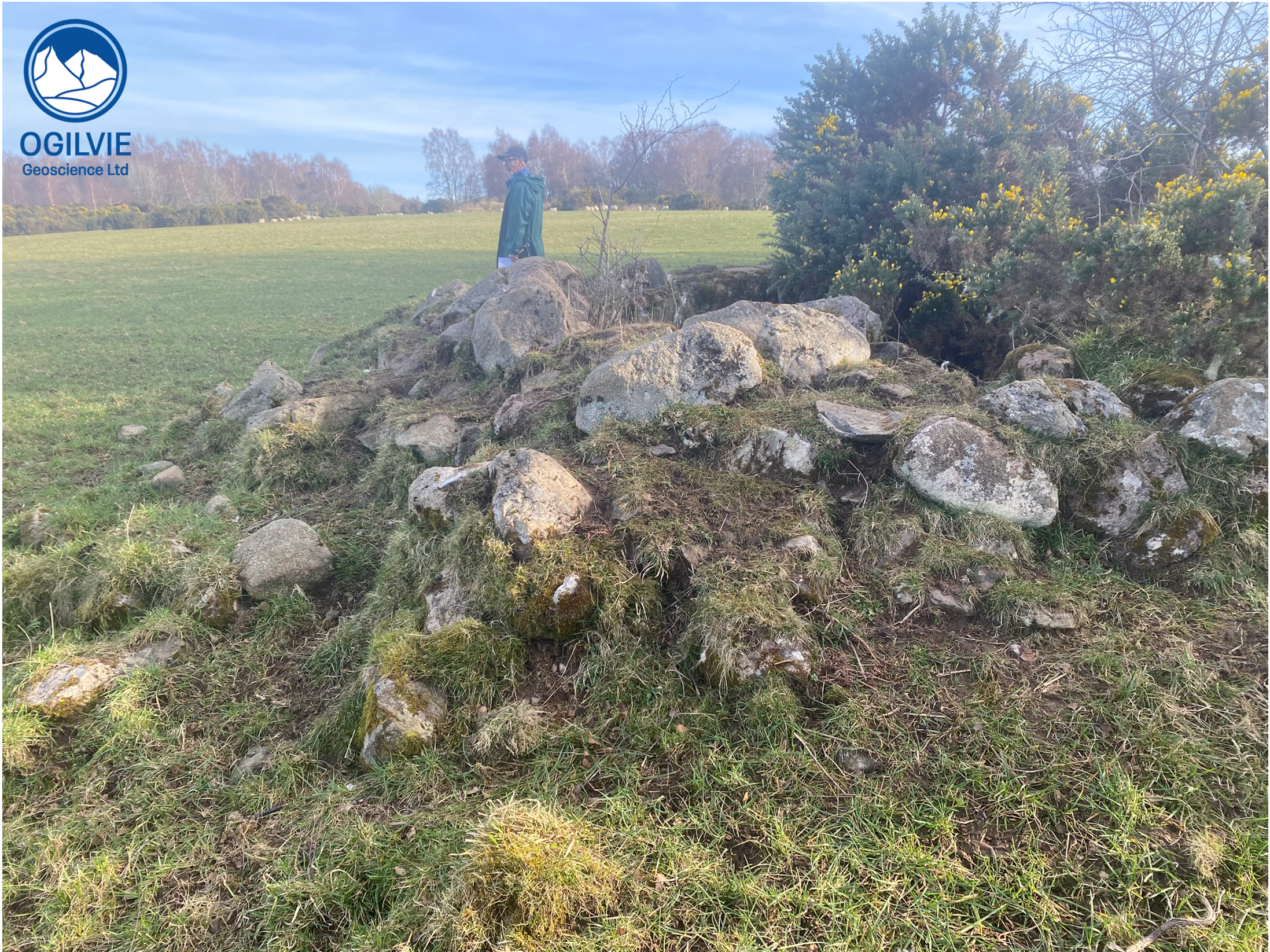
We also stopped at Lethen Bar which is another old quarry and recorded some time ago as ploughed over, as is on cultivated land. There’s been more recent earthworks there so it’s difficult to find evidence of the quarry.
Clune Quarry
Old kiln at Clune and (on right) a sample of bedded limestone found outside of the kiln
The next quarry (at Clune) as around 1.5 km from Lethen House and also does not have any rock exposures - in fact the location of a quarry is inferred here. Mainly due to a wide hole about 1 m deep cut down into the boulder clay.
There is also a limekiln next to the hole which would make sense with regards to using limestone from the fishbeds in the kiln.
No limestone is exposed but there are chunks of bedded limestone around the foot of the outside of the kiln. The limestone is bedded here i.e., not nodular and would therefore be a more suitable candidate for use in the kiln than the nodular limestones at Lethen House Quarry.