
Ailnack Gorge Tomintoul, Scotland
An inland trip this time !
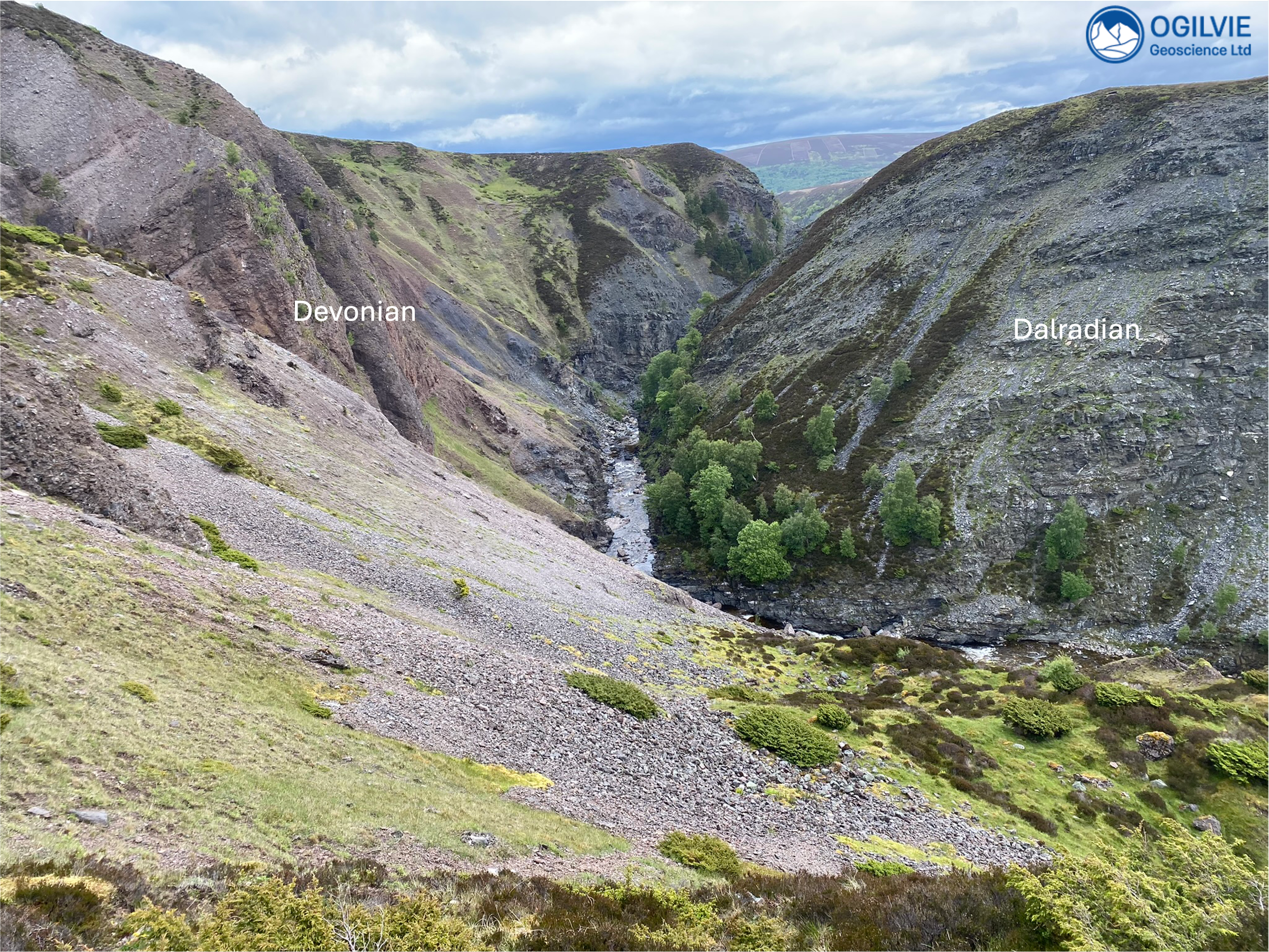
One of my favourite trips with Aberdeen Geological Society during 2024 was up into the Cairngorm mountains to walk to and descend into Ailnack gorge, a 100 m deep feature that was created by glacio-fluvial erosion towards the end of the last glaciation. Our objective was to check out the unconformity and the overlying Devonian conglomerates and see for ourselves how the shape of the unconformity has influenced the topography.
We gathered at the village square in Tomintoul in the Cairngorms National Park (Scotland) and then car shared out onto Delnabo Road at the edge of the village. We parked past the playing fields and walked down to the crossing over the River Avon.
About 15 minutes into this walk, there is a small cliff made of conglomerate on our left hand side before the small bridge over the Avon. These conglomerates in this area are an example of outliers (younger rocks surrounded by older rocks) of Devonian (ORS) north of the highland boundary fault.
First stop is conglomerates
We could call this a basal conglomerate at the unconformable contact with the Dalradian metasedimentary rocks. The fragments in the conglomerate haven’t travelled very far as there are a range of clast sizes and some are quite angular - the clasts have been eroded from steep mountains and have poured off rapidly rising mountains. The environment of deposition is high energy although not overly chaotic to the extent that bedding cannot form as their is a weak bedding. We can see this over the tops of the heads of the group from top right to bottom left.
Dominated by mica-schists, there are no granite clasts (from what we could see) which is a bit strange as we’d expect granite to be sourced from the uplifted mountains. So there’s been no unroofing of the granite. Could the granite be fault controlled ?
Previous trips [1] have reported a steep palaeosurface given the occurrence of the conglomerates at another outcrop across the bridge which is 10s of metres below equivalent exposures at a place (reached before this 1st stop) called Queen’s view.
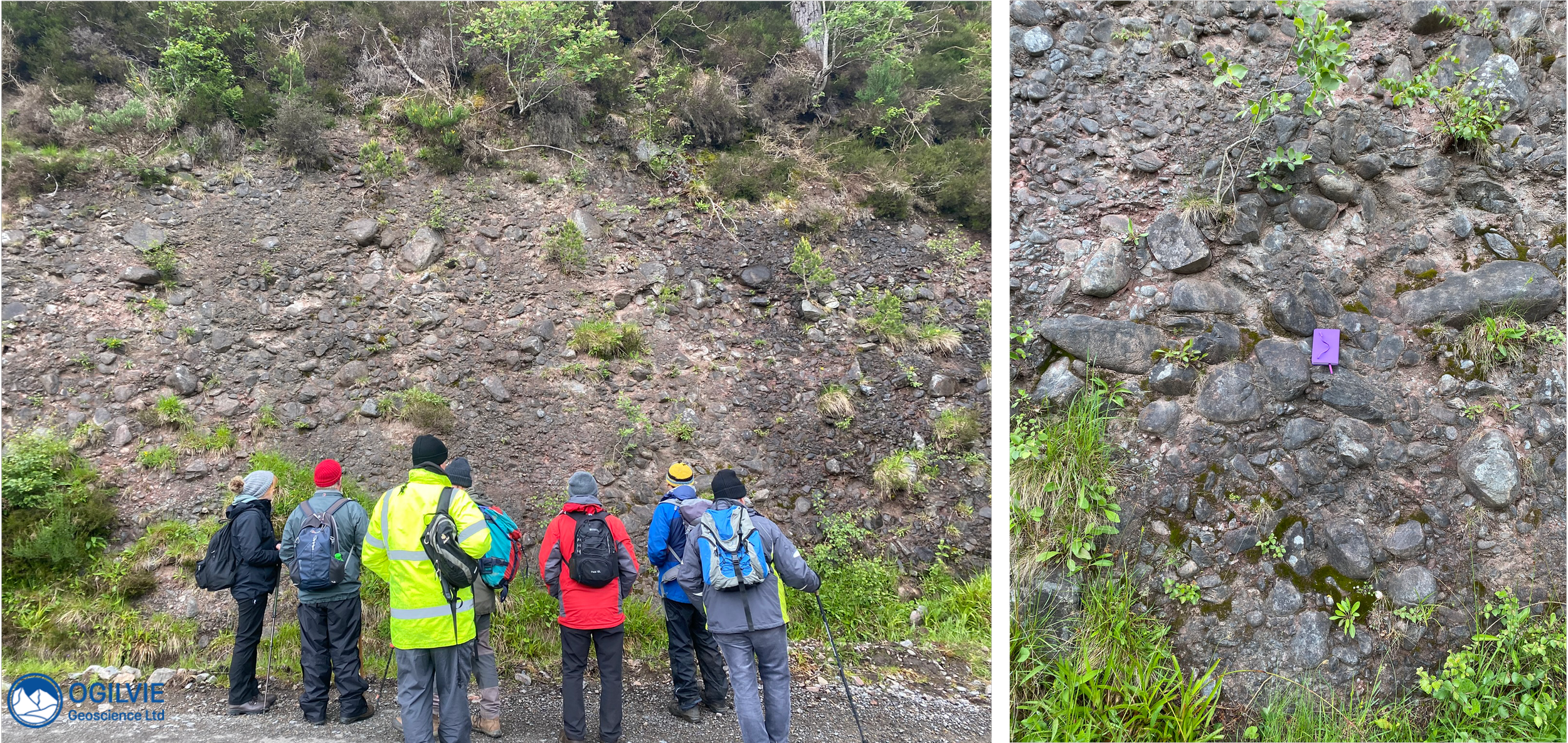
First stop at the basal conglomerates just before the Avon crossing belonging to the (Delnabo Conglomerate Formation) which show some signs of bedding from top right to bottom left
Bonus quarry of glacial material on the way !
On way to the gorge, we came across this small quarry on the left hand side of the path - of what would turn out to be the youngest geological material of the day. It is made up of fluvio-glacial material from the last glaciation. We could see some of the sedimentary structures such as channels - some folks picked out fine cross bedding and pebble imbrication showing a flow direction parallel to the gorge.
I also spotted some small faults in this recent sediment - a steep fault shown by the red line below has a small (cm scale) displacement (note the yellow pencil scale in middle).
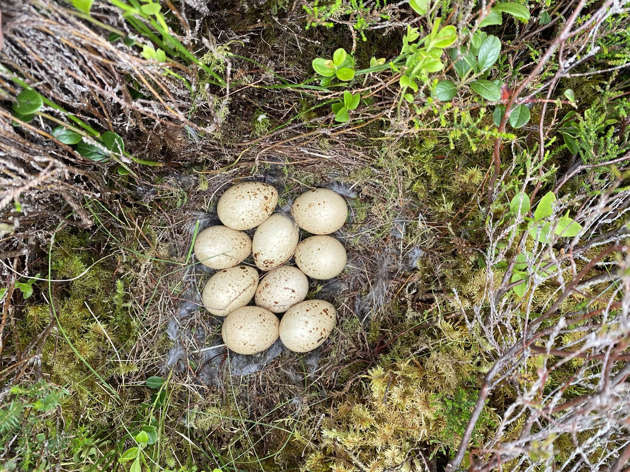
There are many what looks like bird nesting holes on the quarry face..

Quarry of fluvio-glacial sediments on way to the gorge and (right) close up of a small, relatively recent fault exposed on what are fresh exposures.
In Ailnack gorge there are nice examples of recumbent folds..
Carved by water towards the end of the last glaciation, this spectacular feature is up to 3 km long and around 100 m deep. It provides an excellent section through the unconformity together with some exposures along the River Avon. It was quite a tricky descent down a scree slope but worth it to be close to the fresh water of the mountain stream and an opportunity to see some impressive recumbent folds and other structures such as foliation in the Dalradian metamorphic rocks. Apparently the scree slope and ground at the base of the gorge is a good place to find minerals - some folks found some kyanite and purple fluorite on previous trips.
Spectacular view into the gorge
Here’s more views of the gorge showing the dipping Devonian conglomerates on the left and Dalradian metamorphic rocks on the right.
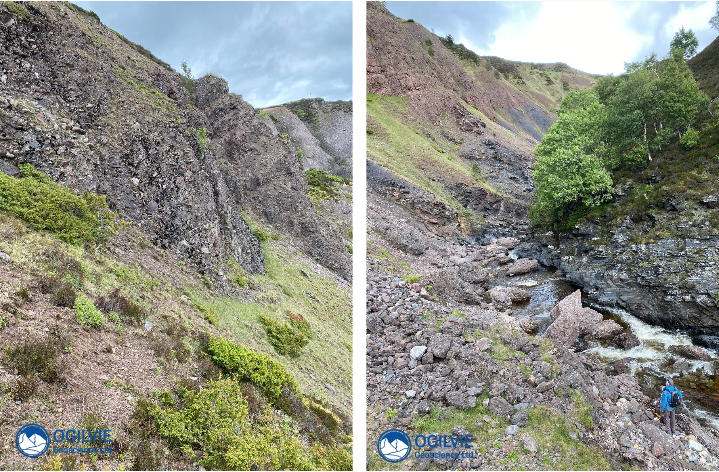
On way down to the gorge with views of dipping conglomerates
Once down at the stream, there are plenty examples of folds in the metamorphic rocks. The one below has a horizontal axial plane and is called a recumbent fold. Recumbent folds have horizontal axial planes and indicate quite intense deformation. Folds are quite common in Scotland’s geology but are not always a result of such intense deformation..
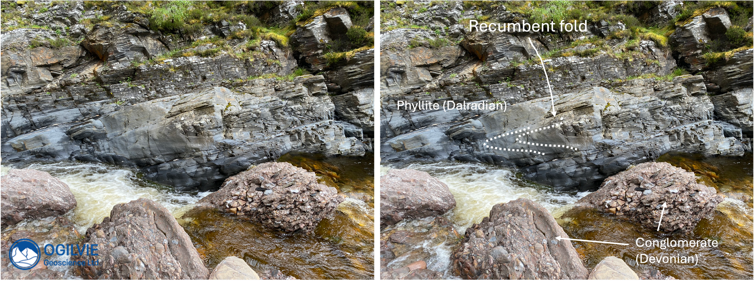
Recumbent folding in the metamorphic rocks of the Dalradian in Ailnack Gorge.
From a distance at the top of the gorge, the metasediments appear to be bedded -but this is a cleavage or foliation which becomes clear when we get close up to the rocks at the bottom of the gorge. Because it trends parallel to a fold axial trace, it is called an axial planar cleavage and given the notation D1. It forms during the compression that creates the folds. Here we can see alignment of small micas although they would be more visible in mica-schists.
A younger direction (D2) is at right angles to D1 and indicates overall intense deformation. At different locations on a fold, the axial planar cleavage can have a steeper or more gentle dip than the bedding (bottom right) - on the more upright limbs the cleavage will be steeper than the bedding, whereas the bedding will be steeper than the cleavage on an overturned limb.
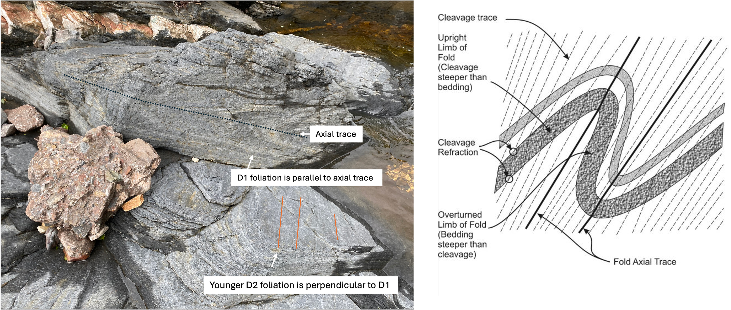
Details of 2 stages of foliation and their relation to folding in the phyllites.
You got to watch where you are putting your feet