
Geology of Inverbervie, East Scotland
Why visit this area ?
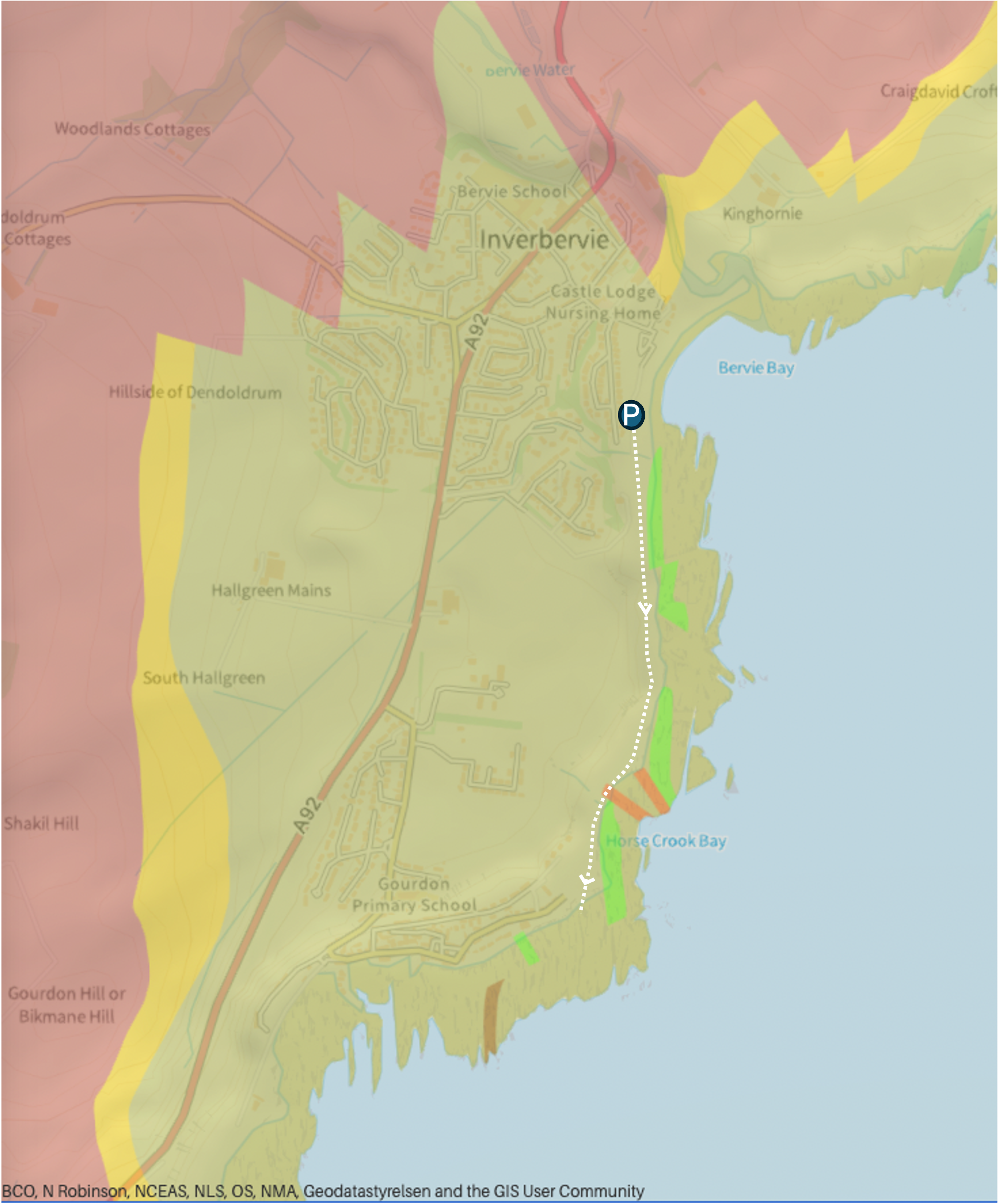
Route and geology map of the area showing the A92 main road and approx walking path (white dashed line) from Inverbervie to Gourdon. The dominant (dull) green colour represents outcrops of Lower ORS conglomerates and sandstones, later disturbed by igneous intrusions along the foreshore. Map from BGS geology viewer.
Not particularly well known - certaintly not a classic area of Scottish geology and not a hugh amount of reading material on it - so that made me curious to take a look .
The geology is varied and there is plenty to see !
A coastal set of Devonian age igneous rocks and sedimentary rocks mainly as wave-cut platforms but also some cliff exposures at the back of the public path.
How to get to this area
From the North (coming from Aberdeen) take a right turn onto the A92 just after Stonehaven. Follow this road into the town of Inverbervie (opposite) and take a left turn (approx half way along the high street) at the bank where there is a signpost to the leisure centre.
Follow this road to the coast and park in the (free) car park right next to the beach. There is easy access to the outcrops southwards along the coast by a good walking path along to the next village of Gourdon.
You can easily leave the path and drop down onto the outcrops or you may want to visit the outcrops right away depending on tides. On my day out, I covered the section to the E of Inverbervie - between Inverbervie and Gourdon (white dashed line opposite). However, there are other cliff sections to the North of Bervie Bay park where the scenery is quite dramatic.
Pebble beach
I didn’t spend a lot of time looking at the pebbles but it seems that all the usual suspects (for these northeastern beaches south of the highland boundary fault) are present - jasper, quartzite, granite, sandstones and gneiss. I have written a blog on pebble spotting on Auchmithie beach to the south of Inverbervie.
https://www.ogilviegeoscience.com/blog/pebble-spotting-on-auchmithie-beach-e-scotland
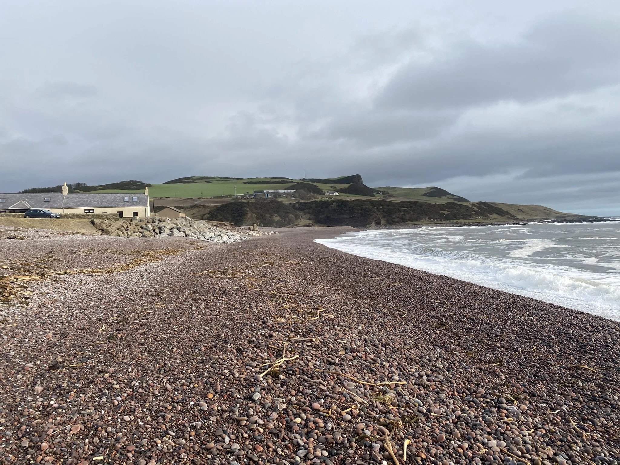
View northwards across the pebble beach and some of the outcrops to the north
The Geology
My first time here so I’m no expert but with the help of the BGS geology viewer here is what I found…
In simple terms, Lower Devonian age sedimentary rocks which have been intruded by a series of different types of intrusion such as dykes and sills. These are the bright green, orange and brown stripes on the dominant dull green background of sedimentary rocks on the map.
The sedimentary rocks are interbedded conglomerates and sandstones belonging to the Gourdon Sandstone Formation. As these may be of Late Silurian to Lower Devonian age, we can call these Old Red Sandstone rocks.
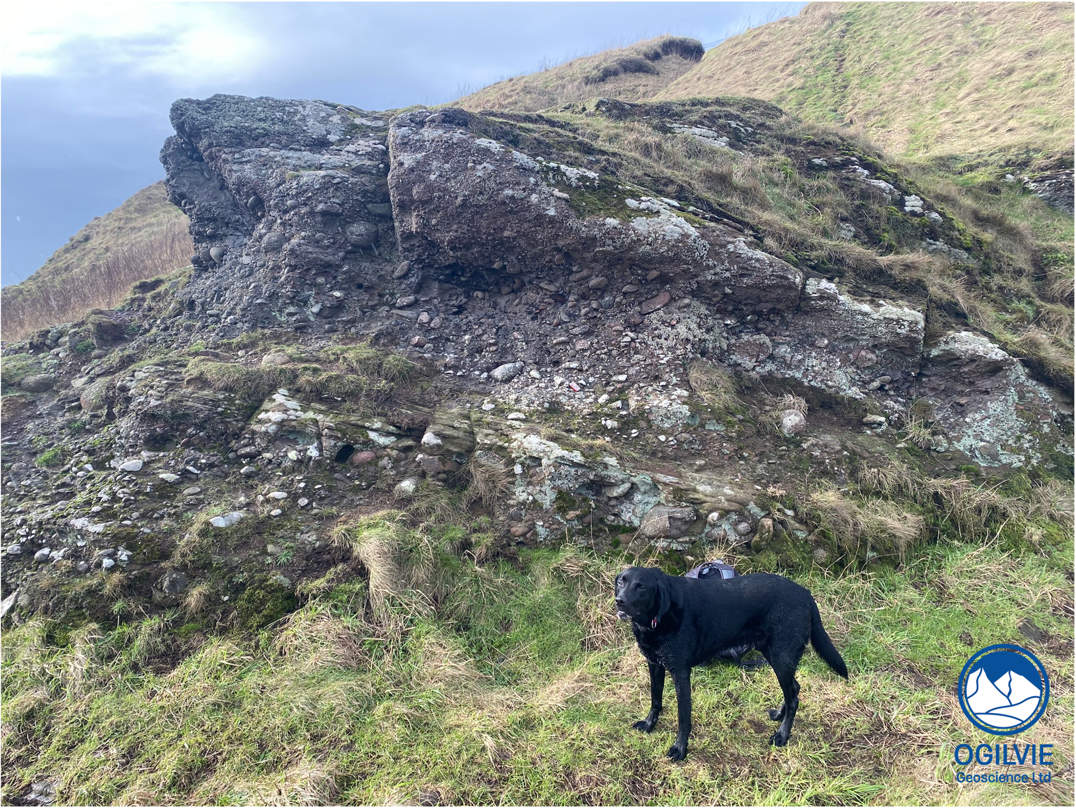
Clearly dipping conglomerates of the Gourdon Sandstone Fm - Onyx the lab for scale
The distinctive greenish - grey coloured exposures at the south end of Bervie Bay are from one of these intrusions. According to the BGS map these are olivine rich mafic rocks - the large (up to a cm) dark green spots on these rocks are likely to be olivine. Next to the (swiss army knife) scale are some large holes in this igneous rock where some large minerals (maybe zeolites) have been plucked out by the sea action. I checked the BGS geology viewer and these silica poor rocks are are olivine-analcime microgabbros dated Carboniferous to Permian in age (358 - 272 Ma).
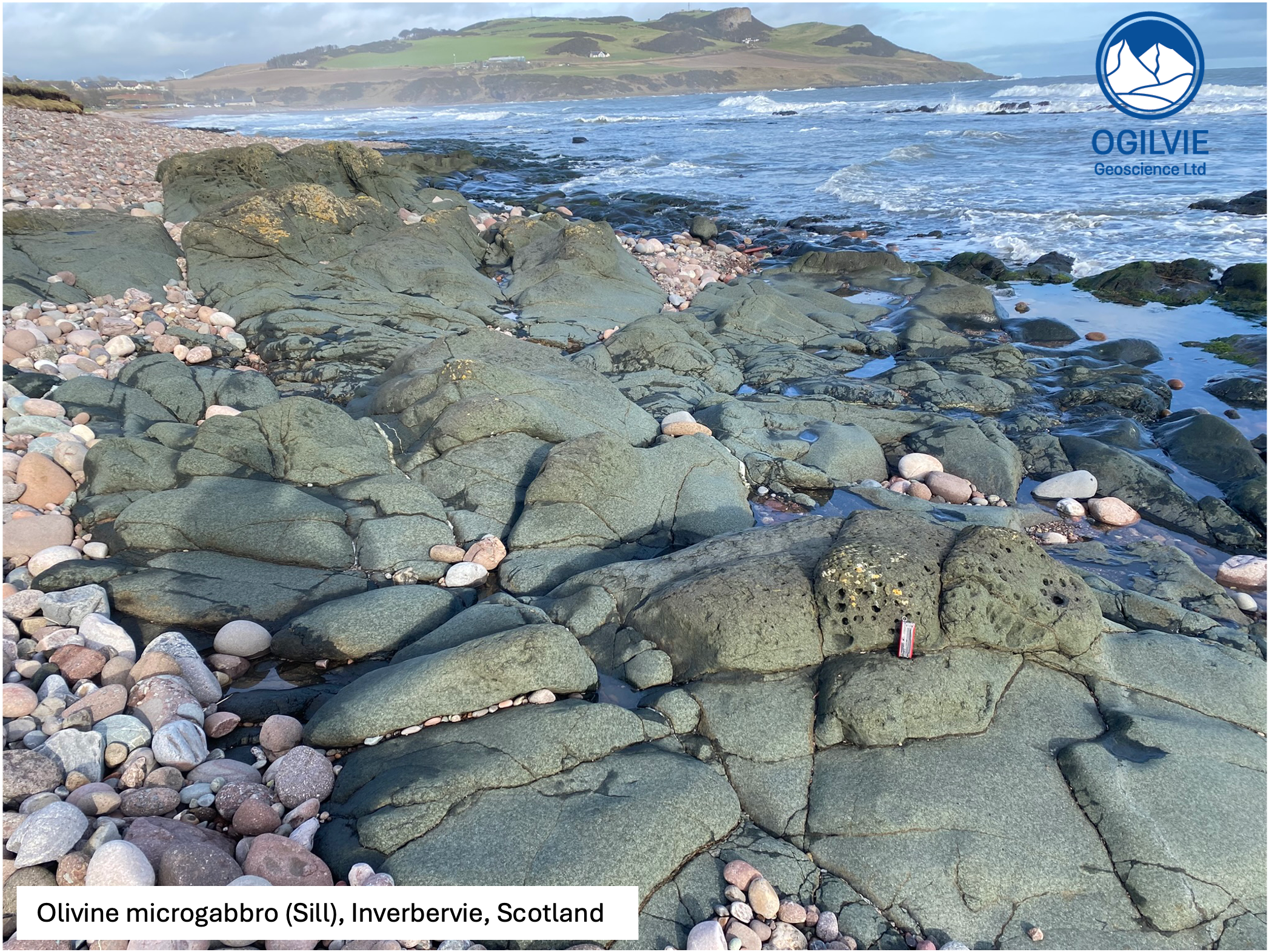
Mafic, olivine rich intrusion at south end of Inverbervie Bay at the start of my walk. The scale is next to a series of large holes (some a few cms diameter) where minerals have been plucked out.
Further along the foreshore (towards Gourdon) on a small promontory at the north end of Horse Crook Bay, there is a clear contact (dashed blue line) between the conglomerates and an intrusive sill.
The sill is made up of a pink coloured igneous rock with large crystals which are a lighter pink than the rock matrix. This type of intrusion is a dyke as it cuts across the sedimentary bedding. It has more silica than the one above as is much lighter in colour and less likely to contain iron rich minerals. These quartz porphyry rocks have a characteristic spotted appearance and can be spotted as pebbles on the Inverbervie bay beach and many other beaches in this area.
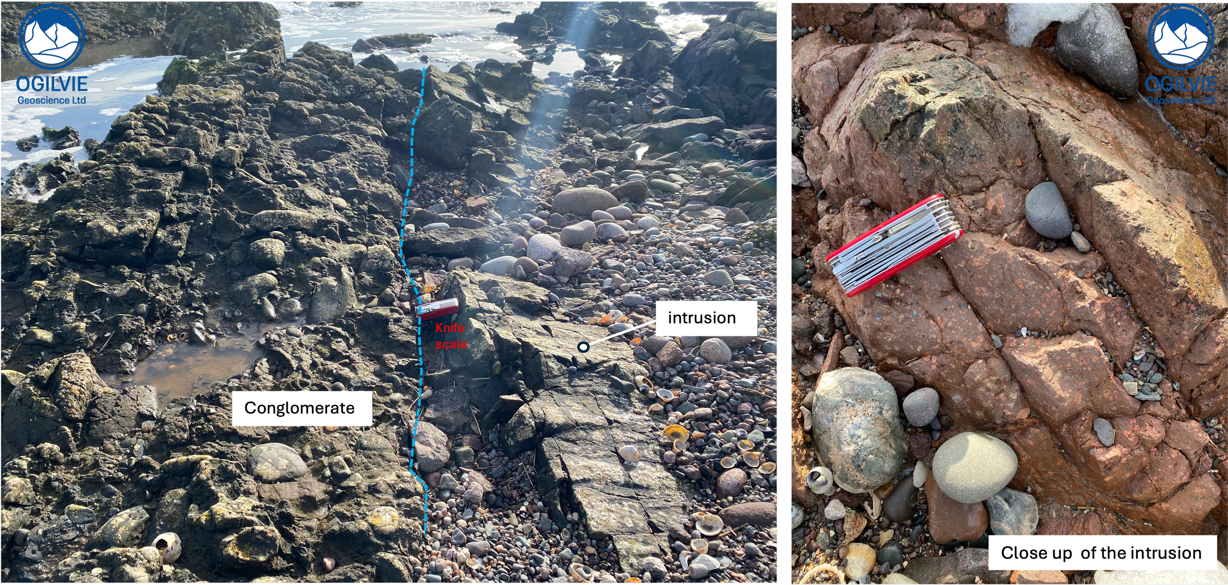
Contact between conglomerate and a dike intrusion- close up of the silica rich, pink coloured intrusive igneous rock
BGS description of the dikes: North Britain Siluro-Devonian Calc-Alkaline Dyke Suite-Quartz-feldspar-porphyry. These igneous rocks are magmatic (intrusive) in origin. Rich in silica, they form intruded batholiths, plutons, dykes and sills.
The conglomerates have quite a dull coloured matrix and the clasts are quite a range of sizes - interestingly there are often large rounded clasts like the igneous clast below. It almost looks the same composition as the porphyry in the intrusion but clearly must be sourced from older rocks.
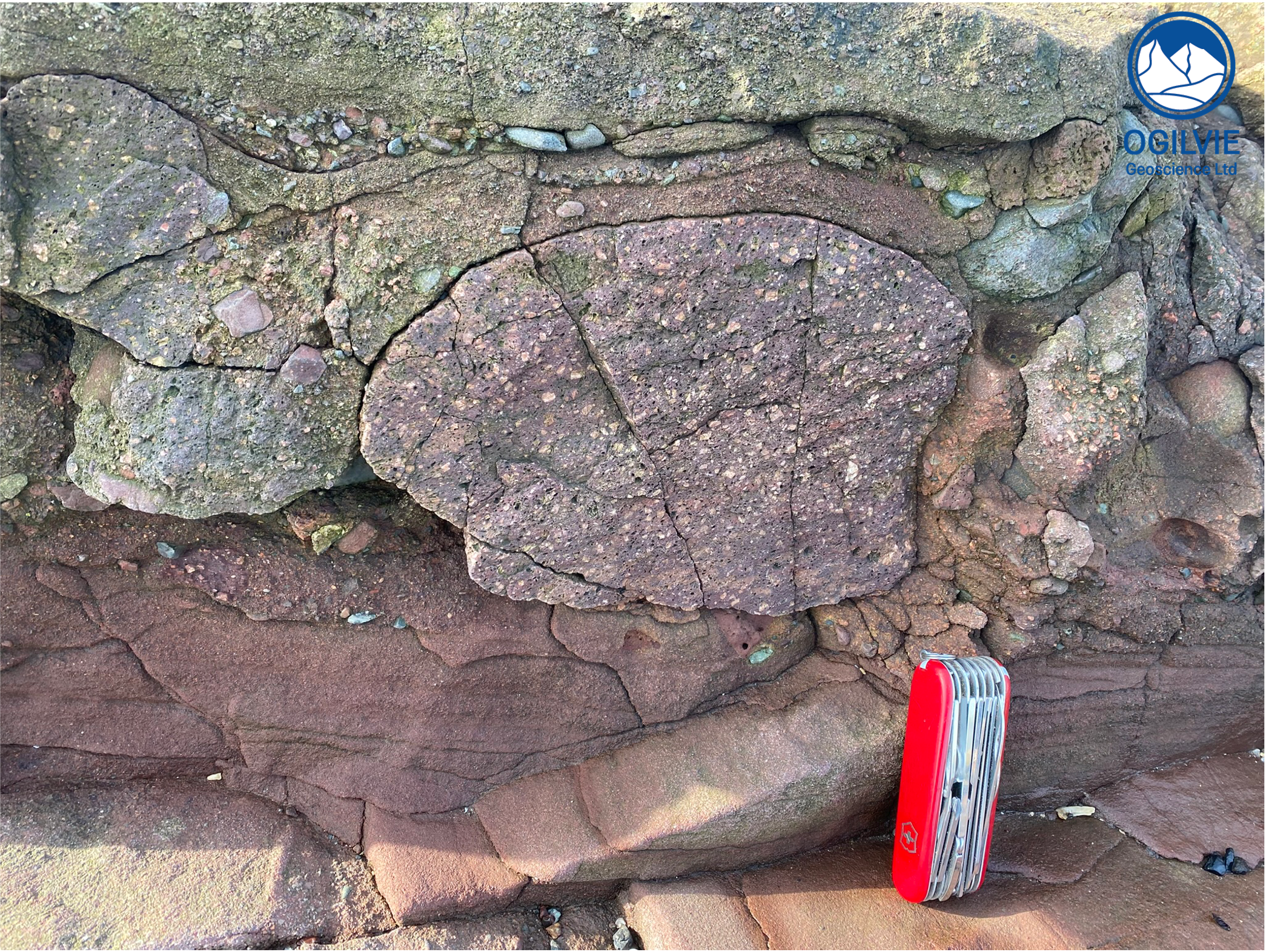
Large, rounded clast of igneous rock within the conglomerates at northern end of Horse Crook Bay - with example of large, rounded clast.
The exposures are mainly highly weathered and slimy with seaweed but it is possible to find fresh exposures next to inlets of water. The fine grained sandstones/siltstones below are less common than the coarse, often pebbly sandstone that directly overlie these freshly exposed layers. The exposed sandstones are stained by a light green/grey calcium carbonate residue which is common in Devonian sediments in the Middle Valley of Scotland.
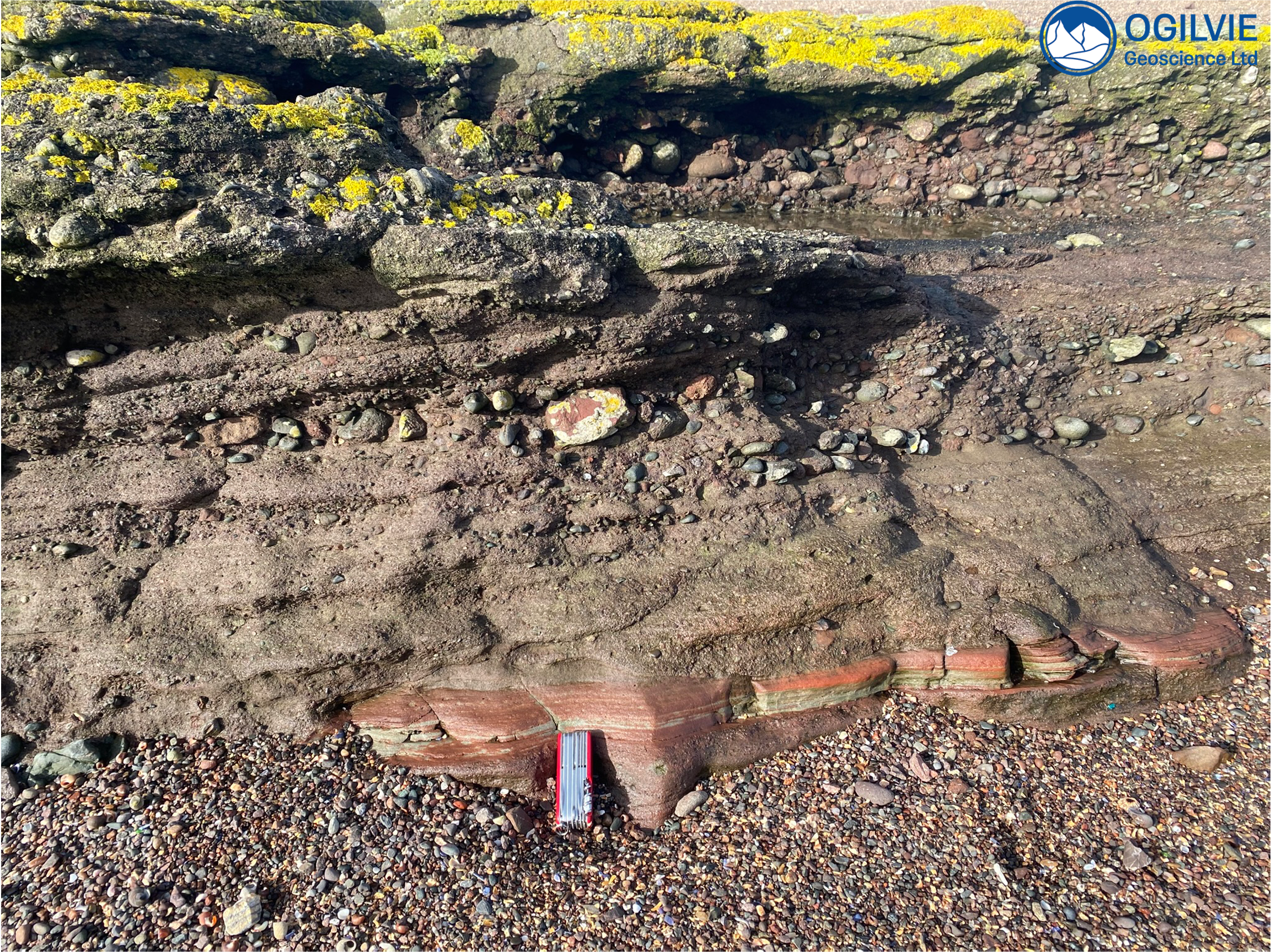
Conglomerates overlying pebbly coarse sandstones and finer grained red sandstones (knife scale) at the bottom of this Lower Devonian exposure - on the foreshore just at the start of Gourdon village.
Faults and fractures
When we look at google earth we can pick out a number of faults running across and along the foreshore - there is one displacing the olivine sill which trends approx SW-NE (see map above). I also noticed some small conjugate faults which we could call shear fractures in some of the pebbles and cobbles on the foreshore.
The schist on the left hand side has a pair of conjugate shear fractures which have clearly provided permeability pathways for water as shown by the stain around the fractures. On the right hand side, the Andy cube is sitting next to a sandstone cobble with a clear Anderson style conjugate shear fracture.
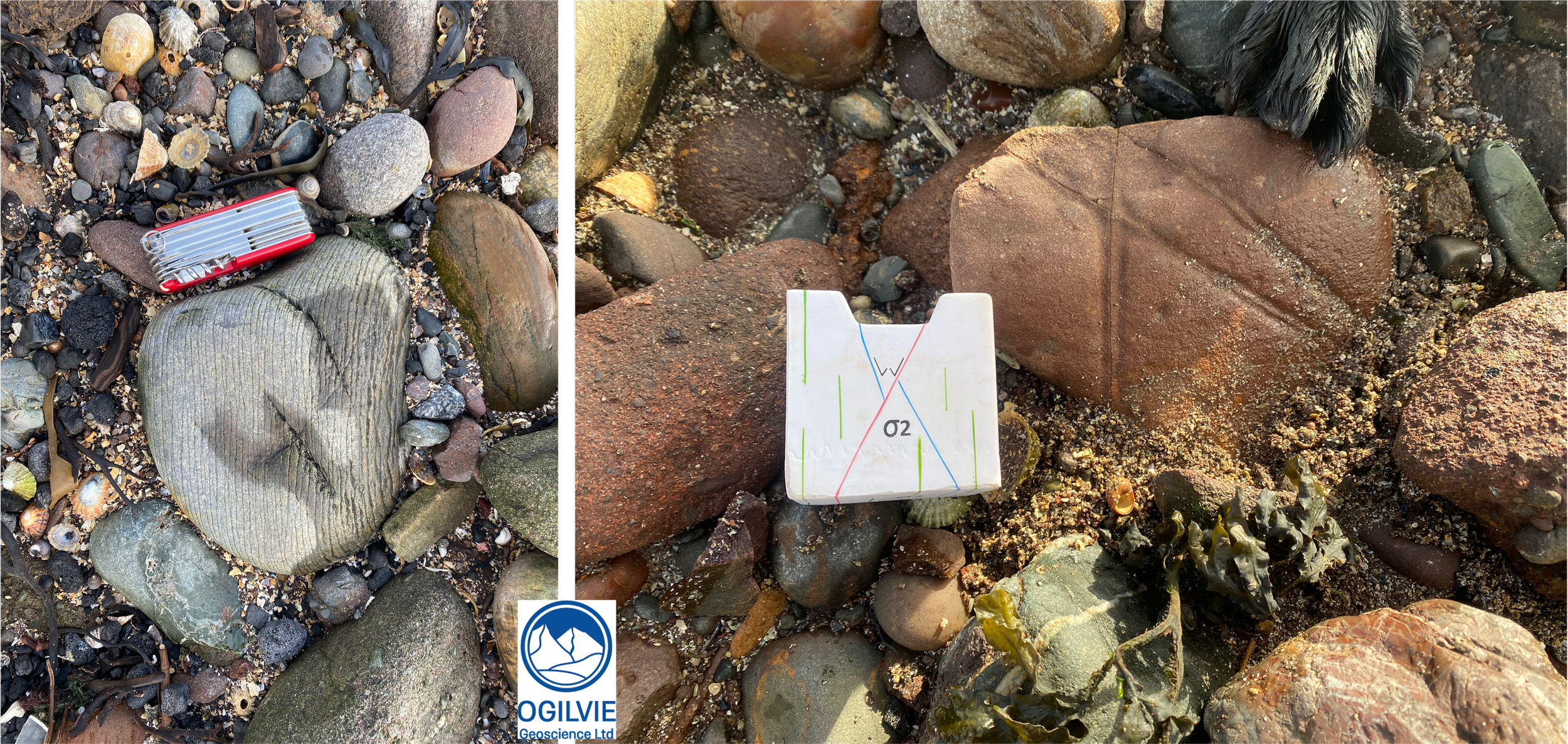
A bit of structural geology on the pebbles and cobbles on the foreshore at Gourdon - note how the water has seeped into the fractures in this schist on the left. On the right the Andy cube is next to a set of conjugate faults in this sandstone.